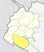
Tikapur
Appearance
This article possibly contains original research. (May 2017) |
Tikapur | |
|---|---|
Municipality | |
| Lua error in Module:Location_map at line 526: Unable to find the specified location map definition: "Module:Location map/data/Nepal Sudurpashchim Pradesh" does not exist. | |
| Coordinates: 28°31′30″N 81°07′15″E / 28.52500°N 81.12083°E | |
| Country | |
| Province | Sudurpashchim Pradesh |
| District | Kailali District |
| Government | |
| • Mayor | Tapendra Rawal (NCP) |
| • Deputy Mayor | Keshari Bista Rawal (NC) |
| Time zone | UTC+5:45 (NST) |
| Postal code | 10901 |
| Area code | 091 |
| Website | tikapurmun.gov.np |
Tikapur (Nepali: टिकापुर) is a Municipality in Kailali District in Sudurpashchim Pradesh of Nepal that was established in January 1997. Tikapur Municipality was further expanded on 10th March 2017 through merger with the two former Village development committees Narayanpur and Dansinhapur.[1] It lies on the bank of Karnali River.
At the time of the 2011 Nepal census it had a population of 98,651 people living in 15,356 individual households. Tikapur is 4th largest city in Sudurpaschim pradesh after Dhangadhi , Bhimdutta (formerly Mahendranagar) and lamki.[2]
Transportation
Tikapur Airport is an out-of-service airport that lies in Tikapur.[3]
References
- ^ "Brief Introduction". Tikapur Municipality. Retrieved 1 May 2018.
- ^ "National Population and Housing Census 2011" (PDF). Central Bureau of Statistics. November 2017. Retrieved 1 May 2018.
- ^ "Tikapur Airport" (PDF). Civil Aviation authority of Nepal. Retrieved 1 May 2018.
External links

