Eliakim
Eliakim | |
|---|---|
 | |
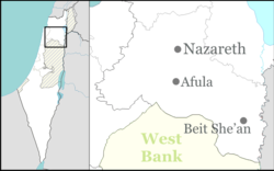
| Coordinates: 32°37′56.63″N 35°3′59.39″E / 32.6323972°N 35.0664972°E | |
| Country | |
| District | Northern |
| Council | Megiddo |
| Affiliation | Moshavim Movement |
| Founded | 1949 |
| Founded by | Yemenite Jews |
| Population (2022)[1] | 969 |
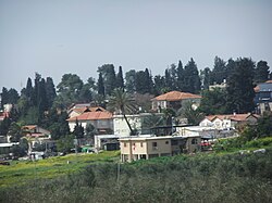
Eliakim (Hebrew: אֶלְיָקִים) is a moshav in northern Israel. Located in the Menashe Heights, it falls under the jurisdiction of Megiddo Regional Council. In 2022 it had a population of 969.[1]
History
The village was established in 1949 as a moshav by Jewish refugees from Yemen on the lands of the depopulated Palestinian village of Umm az-Zinat,[2][3] and was named after Jehoiakim (who was originally named Eliakim), a King of Judah (2 Kings 23:34). In 1970 it was converted to a communal settlement, but returned to being a moshav in 2008.
Notable residents
- Boaz Mauda, winner of season 5 of Kokhav Nolad
References
- ^ a b "Regional Statistics". Israel Central Bureau of Statistics. Retrieved 21 March 2024.
- ^ Khalidi, Walid (1992). All That Remains: The Palestinian Villages Occupied and Depopulated by Israel in 1948. Washington D.C.: Institute for Palestine Studies. p. 200. ISBN 0-88728-224-5.
- ^ Morris, Benny (2004). The Birth of the Palestinian Refugee Problem Revisited. Cambridge: Cambridge University Press. p. xxii, settlement #117. ISBN 978-0-521-00967-6.


