Nanzheng District
Appearance
You can help expand this article with text translated from the corresponding article in Chinese. (December 2008) Click [show] for important translation instructions.
|
Nanzheng
南郑区 Nan-cheng | |
|---|---|
 The Sanmon of the Shengshui Temple (圣水寺) | |
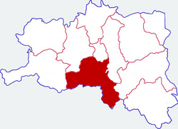
 Location in Hanzhong | |
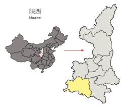
 Hanzhong in Shaanxi | |
| Coordinates: 33°0′N 106°56′E / 33.000°N 106.933°E | |
| Country | People's Republic of China |
| Province | Shaanxi |
| Prefecture-level city | Hanzhong |
| Area | |
| • Total | 2,809.03 km2 (1,084.57 sq mi) |
| Population (2019) | |
| • Total | 477,400 |
| • Density | 170/km2 (440/sq mi) |
| Time zone | UTC+8 (China Standard) |
| Postal code | 723100 |
| Area code | 0916 |
| Website | nanzheng.gov.cn |
Nanzheng District (simplified Chinese: 南郑区; traditional Chinese: 南鄭區; pinyin: Nánzhèng Qū), formerly Nanzheng County (simplified Chinese: 南郑县; traditional Chinese: 南鄭縣), is a district of the city of Hanzhong, Shaanxi province, China, bordering Sichuan province to the south.

Administrative divisions
As 2019, Nanzheng District is divided to 2 subdistricts and 20 towns.[1]
- Subdistricts
- Hanshan Subdistrict (汉山街道)
- Zhongsuoying Subdistrict (中所营街道)
- Towns
|
|
|
References
- ^ "统计用区划代码 www.stats.gov.cn" (in Chinese). XZQH. Retrieved 2021-01-02.
External links
