Bandar Lengeh Airport
Appearance
Bandar Lengeh Airport | |||||||||||
|---|---|---|---|---|---|---|---|---|---|---|---|
| Summary | |||||||||||
| Airport type | Public/Military | ||||||||||
| Owner | Government of Iran | ||||||||||
| Operator | Iran Airports Company Islamic Republic of Iran Navy Aviation | ||||||||||
| Serves | Bandar Lengeh, Iran | ||||||||||
| Elevation AMSL | 66 ft / 20 m | ||||||||||
| Coordinates | 26°31′55.2″N 54°49′29.45″E / 26.532000°N 54.8248472°E | ||||||||||
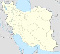
| Map | |||||||||||
 | |||||||||||
| Runways | |||||||||||
| |||||||||||
Source: World Aero Data[1] | |||||||||||
Bandar Lengeh Airport (IATA: BDH, ICAO: OIBL) is an airport in Bandar Lengeh, Iran.[2]
Airlines and destinations
| Airlines | Destinations |
|---|---|
| Iran Air | Bandar Abbas, Shiraz |
| Iran Aseman Airlines | Tehran–Mehrabad |
References
- ^ http://www.worldaerodata.com/wad.cgi?id=IR64634
- ^ "List of all airports in Iran". The Airport Authority. Retrieved 2019-01-02.

