1988 Nepal earthquake
| UTC time | 1988-08-20 23:09:09 |
|---|---|
| ISC event | 429573 |
| USGS-ANSS | ComCat |
| Local date | August 21, 1988 |
| Local time | 04:39 |
| Magnitude | Mw6.9 [1] |
| Depth | 62 km (39 mi) [1] |
| Epicenter | 26°43′N 86°37′E / 26.71°N 86.62°E [1] |
| Type | Oblique-slip [2] |
| Max. intensity | VIII (Severe) [3] |
| Casualties | 709–1,450 [2] |
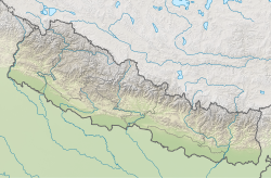
The 1988 Nepal earthquake occurred in Nepal near the Indian border and affected much of northern Bihar.[4] The magnitude 6.9 earthquake shook the region on August 21, killing at least 709 persons and injuring thousands.[5] The earthquake struck in two installments of 10 seconds and 15 seconds each and left cracks in 50,000 buildings, including Raj Bhavan and the old Secretariat Building in Patna, Bihar.
References
- ^ a b c ISC (19 January 2015), ISC-GEM Global Instrumental Earthquake Catalogue (1900–2009), Version 2.0, International Seismological Centre
- ^ a b USGS (September 4, 2009), PAGER-CAT Earthquake Catalog, Version 2008_06.1, United States Geological Survey
- ^ National Geophysical Data Center / World Data Service (NGDC/WDS) (1972), Significant Earthquake Database (Data Set), National Geophysical Data Center, NOAA, doi:10.7289/V5TD9V7K
- ^ "A devastating dawn".
- ^ "In India, J&K, HP, Uttarakhand fall under most active seismic zone".
External links
- M6.9 - Nepal-India border region – United States Geological Survey
- Earthquakes in Bihar, India – Amateur Seismic Centre
- The International Seismological Centre has a bibliography and/or authoritative data for this event.

