
Nullawil
| Nullawil Victoria | |||||||||||||||
|---|---|---|---|---|---|---|---|---|---|---|---|---|---|---|---|
 Calder Highway passing through Nullawil | |||||||||||||||
 Nullawil | |||||||||||||||
| Coordinates | 35°51′0″S 143°11′0″E / 35.85000°S 143.18333°E | ||||||||||||||
| Population | 93 (2016 census)[1] | ||||||||||||||
| Postcode(s) | 3529 | ||||||||||||||
| Location |
| ||||||||||||||
| LGA(s) | Shire of Buloke | ||||||||||||||
| State electorate(s) | Mildura | ||||||||||||||
| Federal division(s) | Mallee | ||||||||||||||
| |||||||||||||||
Nullawil is a locality in Victoria, Australia, located approximately 302 kilometres (188 mi) from the state capital, Melbourne. At the 2016 census, Nullawil had a population of 93.[1]
Nullawil Post Office opened on 26 April 1897.[2]
Gallery
-
 General store
 -
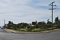 Town park
 -
 St Joseph's Catholic church


References
Wikimedia Commons has media related to Nullawil.
- ^ a b Australian Bureau of Statistics (27 June 2017). "Nullawil (State Suburb)". 2016 Census QuickStats. Retrieved 5 March 2018.
- ^ Premier Postal History. "Post Office List". Retrieved 11 April 2008.
This article about a location in Victoria, Australia is a stub. You can help Wikipedia by expanding it. |