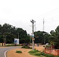
Akkihebbal
This is an old revision of this page, as edited by Prof tpms (talk | contribs) at 09:41, 23 July 2017 (Replaced poor pictures with good ones.). The present address (URL) is a permanent link to this revision, which may differ significantly from the current revision.

Akkihebbalu | |
|---|---|
village | |
 | |
| Coordinates: 12°37′N 76°24′E / 12.617°N 76.400°E / 12.617; 76.400 | |
| Country | |
| State | Karnataka |
| District | Mandya |
| Talukas | Krishnarajpet |
| Government | |
| • Body | Village Panchayat |
| Languages | |
| • Official | Kannada |
| Time zone | UTC+5:30 (IST) |
| Nearest city | Mandya |
| Civic agency | Village Panchayat |

Akkihebbalu is a village in the southern state of Karnataka, India.[1][2] It is located in the Krishnarajpet taluk of Mandya district in Karnataka.
Famous for 800 years old Lakshmi Narasimha Swamy temple constructed by Goutama Maharshi. Famous Rathotsava will be celebrated every year in the month of February. Near to that a very old Eeshwara temple(Konkaneshwara) is located.
TRAVEL GUIDE
Akkihebbalu is well connected by bus and trains to Mysore ,Hassan ,Mandya Bangalore and other nearest .cities.
Akkihebbalu is located 70 km from Mandya,60 km from Mysore ,65 Km from Hassan and 170 km from Bangalore.
Image gallery
-
Main Road
-
Railway Station
- ^ "Census of India : List of Villages Alphabetical Order > Karnataka". Registrar General & Census Commissioner, India. Retrieved 2008-12-18.[permanent dead link] , Census Village code= 2312000
- ^ "Yahoo! maps India :". Archived from the original on 2008-12-18. Retrieved 2009-04-17.
{{cite web}}: Unknown parameter|deadurl=ignored (|url-status=suggested) (help) Akkihebbalu, Mandya, Karnataka
External links
This article related to a location in Mandya district, Karnataka, India is a stub. You can help Wikipedia by expanding it. |
- Pages using gadget WikiMiniAtlas
- All articles with dead external links
- Articles with dead external links from October 2016
- Articles with permanently dead external links
- CS1 errors: unsupported parameter
- Articles with short description
- Short description is different from Wikidata
- Infobox mapframe without OSM relation ID on Wikidata
- Coordinates on Wikidata
- Pages using infobox settlement with no map
- All stub articles
- Pages using the Kartographer extension


