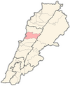
Ashqout
Appearance
Ashqout
عشقوت | |
|---|---|
Municipality | |
| Coordinates: 33°59′14″N 35°42′27″E / 33.987353°N 35.707626°E | |
| Country | |
| Governorate | Mount Lebanon |
| District | Keserwan |
| Area | |
| • Total | 5.88 km2 (2.27 sq mi) |
| Elevation | 1,250 m (4,100 ft) |
| Time zone | UTC+2 (EET) |
| • Summer (DST) | UTC+3 (EEST) |
| Dialing code | +961 |
Ashqout (Arabic: عشقوت; also spelled Ashkout, Achqout, `Ashqut) is a town and municipality in the Keserwan District of the Mount Lebanon Governorate of Lebanon. It is located 31 kilometers north of Beirut. Ashqout's average elevation is 1,000 meters above sea level and its total land area is 588 hectares.[1] Its inhabitants are predominantly Maronite Catholic, with Christians from other denominations in the minority.[2]
The town has three schools, one public and two private, in the town, with a total of 739 students as of 2008.[1] The El-Hajj Hospital, which has 28 beds, is located in Ashqout.[1] It is the birthplace of Ahmad Faris Shidyaq (1804-1887) and the Maronite Patriarch Paul Peter Massad (1806–1890).
References
- ^ a b c "Aachqout". Localiban. Localiban. 2008-01-18. Retrieved 2009-07-24.
- ^ "Elections municipales et ikhtiariah au Mont-Liban" (PDF). Localiban. Localiban. 2010. p. 19. Archived from the original (pdf) on 2015-07-24. Retrieved 2016-02-12.
{{cite web}}: Unknown parameter|deadurl=ignored (|url-status=suggested) (help)


