
Barcelona–Cerbère railway
| Barcelona–Cerbère railway | |
|---|---|
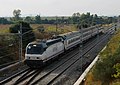
 Renfe Operadora's Estrella "Costa Brava" train hauled by a locomotive 252.040 near Vilamalla station | |
| Overview | |
| Native name | Línia Barcelona-Cervera de la Marenda |
| Status | Operational |
| Owner | Adif |
| Line number | Template:RdC lines, Template:RdC lines, Template:RdC lines, Template:RdC lines, Template:RdC lines |
| Locale | Catalonia |
| Termini | |
| Service | |
| Type | Heavy rail |
| Route number | 270[1] |
| Operator(s) | Renfe Operadora |
| History | |
| Opened | 1854 |
| Technical | |
| Line length | 168.1 km (104.5 mi) |
| Number of tracks | 2 |
| Character | At-grade[a] |
| Track gauge | 1,668 mm (5 ft 5+21⁄32 in) Iberian gauge |
| Electrification | 3 kV DC overhead lines |
| Operating speed | 160 km/h (99 mph) |
The Barcelona–Cerbère railway is a 168-kilometre (104.39 mi) railway line linking Barcelona in Catalonia, Spain to Cerbère in France.
History
It was built between 1858 and 1878 and electrified between 1981 and 1982 .
Gallery
-

-
 Freight train on the line
 -
 Regional train
 -
 Estrella
 -

-
 Locomotive 252.075 with the Catalan Talgo.


Notes
References
- ^ "Listado de líneas y estaciones" (PDF) (in Spanish). Ministry of Public Works and Transport, Government of Spain. Archived from the original (PDF) on October 18, 2013. Retrieved June 27, 2014.
{{cite web}}: Unknown parameter|deadurl=ignored (|url-status=suggested) (help); Unknown parameter|trans_title=ignored (|trans-title=suggested) (help)
External links
![]() Media related to Barcelona–Cerbère railway at Wikimedia Commons
Media related to Barcelona–Cerbère railway at Wikimedia Commons
- Adif. Official website of the railway's owner
| Rail service |
|  | ||||||||||
|---|---|---|---|---|---|---|---|---|---|---|---|---|
| Rolling stock | ||||||||||||
| Infrastructure | ||||||||||||