
Canehill, Arkansas
Canehill, Arkansas | |
|---|---|
 Canehill Post Office | |
 Canehill, Arkansas Canehill's position in Arkansas. | |
| Coordinates: 35°54′31″N 94°23′48″W / 35.90861°N 94.39667°W | |
| Country | United States |
| State | Arkansas |
| County | Washington |
| Township | Cane Hill |
| Established | 1839 |
| Elevation | 1,319 ft (402 m) |
| Time zone | UTC-6 (Central (CST)) |
| • Summer (DST) | UTC-5 (CDT) |
| Zip code | 72717 |
| Area code | 479 |
| GNIS feature ID | 76520 |
| U.S. Geological Survey Geographic Names Information System: Canehill, Arkansas | |
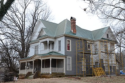
Canehill (formerly Cane Hill and Boonsboro) is an unincorporated community in Washington County, Arkansas, United States. The community is located in the Ozark Mountains on the outskirts of the Northwest Arkansas metropolitan area. One of the most historic communities in the state, Canehill contains seventeen listings on the National Register of Historic Places (NRHP). The Cane Hill College began operations in 1834, which led to the rapid growth and development of the community as a center of higher education. The college and community suffered during the Civil War, and was bypassed by the railroad, which chose a route through Lincoln. Recently, restoration and preservation of many historic buildings has been undertaken by a nonprofit organization, Historic Cane Hill Inc.
Geography
The post office at Canehill is located at 35°54′33″N 94°23′48″W / 35.90917°N 94.39667°W (35.9092280, -94.3967008) and is 1322 feet above sea level.[2] Canehill is on Arkansas Highway 45, approximately 25 miles (40 km) southwest of Fayetteville and 6 miles (9.7 km) east of the Oklahoma border.
Considered a postal designation (ZIP code 72717), the population of the ZCTA was 847[3] at the 2000 census.
History
Cane Hill College
In 1834, the Cumberland Presbyterians established the first collegiate learning institute in Arkansas, naming it the Cane Hill School, after a nearby geological feature.[4] The current Post Office was opened in 1839 and was originally unnamed. In 1843, it was named Boonsboro, and the town maintained this name throughout the American Civil War.
Civil War

The year of 1862 brought the Battle of Cane Hill.
Postbellum years and decline

In 1897, the Cumberland Presbyterian Church considered Cane Hill College[5] as the starting point for their "state" college. However, due to the nearby competition from Arkansas Industrial University, the decline of Cane Hill as a population center and its remote location, the Synod decided to open Arkansas Cumberland College[6] in Clarksville, Arkansas, a more centralized location. In 1891, Cane Hill College closed its doors permanently. In 1901, the community's name was changed to the current usage, that of Canehill.[2]
Economy
Early settlers were attracted to the area by natural springs, which were used in agricultural operations. The community served as a trading post and regional center for apple orchards to sell crops to merchants from Fort Smith. The locals also produced and sold sorghum, a tradition continuing today at the annual harvest festival.
Points of interest
-

-
-
 Cane Hill Museum
 -

-

-

-
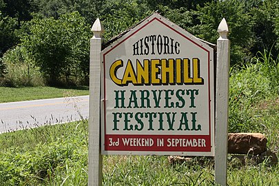 Harvest Festival Sign
 -

-
 Streetside in Cane Hill
 -
 Trail
Trail


Notes
- ^ U.S. Geological Survey Geographic Names Information System: Canehill, Arkansas
- ^ a b U.S. Geological Survey Geographic Names Information System: Canehill, Arkansas Canehill post office
- ^ U.S. Census Bureau Fact Finder Fact Sheet for ZCTA 72717
- ^ About Ozarks - Cane Hill School
- ^ About Ozarks - Cane Hill College
- ^ About Ozarks - Arkansas Cumberland College
