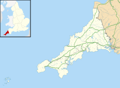
Carbis Bay
50°11′48″N 5°27′54″W / 50.19659°N 5.46505°W


Carbis Bay (Template:Lang-kw, meaning cove beside the eminence) is a seaside resort and village (Template:Lang-kw, meaning causeway) in Cornwall, England, UK. It lies one mile southeast of St Ives, on the western coast of St Ives Bay, on the Atlantic coast.[1] The South West Coast Path passes above the beach.
Geography
Carbis Bay is almost contiguous with the town of St Ives and is in St Ives civil parish (part of the area served by St Ives Town Council), which encompasses St Ives, Carbis Bay, Lelant and Halsetown. The 2001 census gave the combined population of Carbis Bay and Lelant as 3,482.[2] Lelant, an older settlement which is one mile to the south-east, Carbis Bay and St Ives are linked by the A3074 road which joins the A30 at Rose-an-Grouse. Carbis Bay railway station, above the beach, is one of six railway stations on the St Ives Bay Line which joins the mainline at St Erth railway station, which is also at Rose-an-Grouse. St Erth station is the junction for the main line to London Paddington.[1]
Carbis Bay overlooks the small bay of the same name (part of St Ives Bay) which is bounded to the north by Porthminster Point and to the east by Hawk's Point and contains a popular family beach. Hawk's Point is within the Hayle Estuary and Carrack Gladden Site of Special Scientific Interest (SSSI) and in the Victorian era was known locally for its pleasure grounds. The garden had a tea house, grotto and was a venue for Sunday School outings, Band of Hope galas, etc.[3] By 1880 the proprietor, William Payne, claimed in an advertisement that it was ″the largest establishment of the kind in the West ...″.[4]
Mining
Wheal Providence mine in Carbis Bay is the type locality of the rare mineral Connellite.[5]
Notable structures
The parish church, which is dedicated to St Anta and All Saints, contains a peal of ten bells. This was the largest peal in a Cornish parish church until St Keverne's bells was increased to ten in 2001.[6] The Carbis Bay Hotel, on the seafront, was built in 1894 by Silvanus Trevail. Behind the village stands the Knill Monument, known locally as "The Steeple", a 50-foot (15 m) high monument to John Knill, a mayor of nearby St Ives during the 18th-century.
Schools
St Uny Primary School, a Church of England School voluntarily controlled by the Diocese of Truro, is situated in Carbis Bay.[7]
References
- ^ a b Land's End 102 Explorer (Map). Southampton: Ordnance Survey. 2015. ISBN 978 0 319 24304 6.
- ^ Cornwall Population
- ^ "The Future (And Some Of The Present) Men And Women Of St Ives And Their Pastime". The Cornishman. No. 60. 4 September 1879. p. 3.
- ^ "Carbis Bay". The Cornishman. No. 96. 13 May 1880. p. 2.
- ^ "Wheal Providence, Providence Mines, Carbis Bay, Lelant, St Ives District, Cornwall, England, UK". Mindat.org. Retrieved 22 November 2016.
- ^ Dove, R. H. (2012) A Bellringer's Guide to the Church Bells of Britain and Ringing Peals of the World, 10th ed. Guildford: Viggers
- ^ "St Uny School". Retrieved 21 March 2016.
External links
![]() Media related to Carbis Bay at Wikimedia Commons
Media related to Carbis Bay at Wikimedia Commons

