
Carversville Historic District
Carversville Historic District | |
 Carversville Inn. November 2012. | |
  | |
| Location | Off PA 32, Carversville, Pennsylvania |
|---|---|
| Coordinates | 40°23′09″N 75°03′35″W / 40.38583°N 75.05972°W |
| Area | 188 acres (76 ha) |
| Architectural style | Colonial, Late Victorian, Federal |
| NRHP reference No. | 78003418[1] |
| Added to NRHP | December 13, 1978 |
Carversville Historic District is a national historic district located at Carversville, Solebury Township, Bucks County, Pennsylvania. The district includes 57 contributing buildings in the village of Carversville. The buildings include notable examples of the Late Victorian and Federal styles. Notable buildings are the Overpeck Homestead (c. 1703-1716), Fred Clark Art Museum (1873), and Carversville Christian Church (1866).[2]
It was added to the National Register of Historic Places in 1978.[1]
Gallery
-
 Carversville General Store and Post Office.
 -
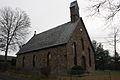
 Carversville Christian Church.
 -
 Aquetong Road.
 -
 Corner of Carversville Rd. and Wismer Rd.
 -
 Carversville Rd.
 -
 Fred Clark Art Museum.


References
- ^ a b "National Register Information System". National Register of Historic Places. National Park Service. July 9, 2010.
- ^ "National Historic Landmarks & National Register of Historic Places in Pennsylvania" (Searchable database). CRGIS: Cultural Resources Geographic Information System. Note: This includes Alvin S. Roberts (n.d.). "National Register of Historic Places Inventory Nomination Form: Carversville Historic District" (PDF). Retrieved 2012-10-19.
Wikimedia Commons has media related to Carversville Historic District.

This article about a property in Bucks County, Pennsylvania on the National Register of Historic Places is a stub. You can help Wikipedia by expanding it. |