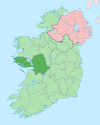
Dinish Island
Appearance
| Geography | |
|---|---|
| Location | Atlantic Ocean |
| Coordinates | 53°15′43″N 9°45′14″W / 53.262°N 9.754°W |
| Highest elevation | 40 m (130 ft) |
| Administration | |
| Demographics | |
| Population | 0 |
Dinish, (Irish: Deighinis), is a small island on the coast of Connemara in County Galway, Ireland.
Geography
The island is connected to the island of Lettermullen and is part of a group of islands collectively known as Ceantar na nOileán.[2] The island has no permanent population and is not connected via a bridge, however access is possible via boat or on foot at low tide.
History
The island has had a permanent population in recent history with a population of nine families in 1911.[3]
Dinish is mentioned in the essay "In Connemara" by John Millington Synge.[citation needed]
|
|
| ||||||||||||||||||||||||||||||||||||||||||||||||||||||||||||||||||||||||||||||
| Source: Central Statistics Office. "CNA17: Population by Off Shore Island, Sex and Year". CSO.ie. Retrieved October 12, 2016. | ||||||||||||||||||||||||||||||||||||||||||||||||||||||||||||||||||||||||||||||||
References
- ^ a b Ordnance Survey Ireland's 19th-century 6" maps
- ^ "South Connemara Islands". Irelandbyways.com. 2007-03-27. Retrieved 2013-12-04.
- ^ "National Archives: Census of Ireland 1911". The National Archives of Ireland. Retrieved 2013-12-04.


