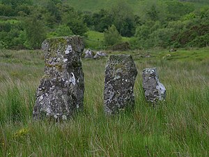
Drumskinny
Appearance

Drumskinny (from Irish Droim Scine 'knife ridge') is the site of a stone circle in the townland of Drumskinny, County Fermanagh, Northern Ireland. With the inclusion of an adjacent cairn and alignment, the stone circle is a State Care Historic Monument in Fermanagh District Council area, at grid ref: H 2009 7072.[1][2] The site was excavated in 1962[3] and is believed to have built around 2000 BC.[4]
See also
External links
References
Wikimedia Commons has media related to Drumskinny.
- ^ "Drumskinny" (PDF). Environment and Heritage Service NI - State care Historic Monuments. Retrieved 2007-12-03.
- ^ "Drumskinny". The Megalithic Portal. Retrieved 2007-12-02.
- ^ "Drumskinny Stone Circle". Irish Antiquities. Retrieved 2010-10-06.
- ^ "Drumskinny Stone Circle". Triskelle. Retrieved 2007-12-02.
