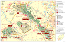
Hambach surface mine
Appearance
This article needs additional citations for verification. (February 2010) |

The Tagebau Hambach is a large open-pit mine (Template:Lang-de) in Niederzier and Elsdorf, North-Rhine Westphalia, Germany. It is operated by RWE and used for mining lignite. Begun in 1978, the mine currently has a size of 33.89 km² and is planned to eventually have a size of 85 km². It is the deepest open pit mine with respect to sea level, where the bottom of the pit is 293 metres (961 ft) below sea level.
50°54′39″N 6°30′10″E / 50.91083°N 6.50278°E
Wikimedia Commons has media related to Tagebau Hambach.
See also
External links


