
Kay County, Oklahoma
Kay County | |
|---|---|
 Location within the U.S. state of Oklahoma | |
 Oklahoma's location within the U.S. | |
| Coordinates: 36°49′N 97°08′W / 36.81°N 97.14°W | |
| Country | |
| State | |
| Seat | Newkirk |
| Area | |
| • Total | 945 sq mi (2,448 km2) |
| • Land | 919 sq mi (2,379 km2) |
| • Water | 26 sq mi (68 km2) 2.80% |
| Population (2000) | |
| • Total | 48,080 |
| • Density | 52/sq mi (20/km2) |
| Time zone | UTC−6 (Central) |
| • Summer (DST) | UTC−5 (CDT) |
| Congressional district | 3rd |
Kay County is a county located in the U.S. state of Oklahoma. As of 2000, the population was 48,080. Its county seat is NewkirkTemplate:GR. The largest city in Kay County is Ponca City.
Geography
According to the U.S. Census Bureau, the county has a total area of 945 square miles (2,448 km²), of which, 919 square miles (2,379 km²) of it is land and 26 square miles (68 km²) of it (2.80%) is water. Kay County is the only county to keep its same name ("K" County) as the Oklahoma area moved from a territory to a state. The highest point in Kay County, Oklahoma, is on Hubbard Road. The elevation is 1,011 feet above sea level.
Major highways
Adjacent counties
- Cowley County, Kansas (north)
- Osage County (east)
- Noble County (south)
- Garfield County (southwest)
- Grant County (west)
Demographics
As of the censusTemplate:GR of 2000, there were 48,080 people, 19,157 households, and 13,141 families residing in the county. The population density was 52 people per square mile (20/km²). There were 21,804 housing units at an average density of 24 per square mile (9/km²). The racial makeup of the county was 84.16% White, 1.79% Black or African American, 7.53% Native American, 0.53% Asian, 0.02% Pacific Islander, 1.98% from other races, and 4.00% from two or more races. 4.25% of the population were Hispanic or Latino of any race.
There were 19,157 households out of which 31.90% had children under the age of 18 living with them, 54.70% were married couples living together, 10.20% had a female householder with no husband present, and 31.40% were non-families. 27.90% of all households were made up of individuals and 13.10% had someone living alone who was 65 years of age or older. The average household size was 2.45 and the average family size was 2.99.
In the county, the population was spread out with 26.40% under the age of 18, 8.80% from 18 to 24, 25.00% from 25 to 44, 22.80% from 45 to 64, and 17.00% who were 65 years of age or older. The median age was 38 years. For every 100 females there were 93.70 males. For every 100 females age 18 and over, there were 89.90 males.
The median income for a household in the county was $30,762, and the median income for a family was $38,144. Males had a median income of $30,431 versus $19,617 for females. The per capita income for the county was $16,643. About 12.40% of families and 16.00% of the population were below the poverty line, including 22.70% of those under age 18 and 9.50% of those age 65 or over.
Cities and towns
NRHP sites
The following sites in Kay County are listed on the National Register of Historic Places:
|
|
References
Municipalities and communities of Kay County, Oklahoma, United States | ||
|---|---|---|
| Cities | 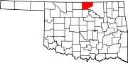 | |
| Towns | ||
| CDPs | ||
| Other communities | ||
| Ghost towns | ||