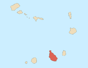
Longueira, Cape Verde
Longueira, Cape Verde | |
|---|---|
Settlement | |
| Coordinates: 15°02′55″N 23°36′40″W / 15.0486°N 23.6111°W | |
| Country | Cape Verde |
| Island | Santiago |
| Municipality | São Lourenço dos Órgãos |
| Civil parish | São Lourenço dos Órgãos |
| Population (2010)[1] | |
| • Total | 326 |
| ID | 78108 |
Longueira is a village in the southcentral part of the island of Santiago, Cape Verde. Its 2010 population was 326. Longueira is located 4 km southwest of João Teves and less than 2 km west of São Jorge dos Órgãos and is also in the end of the branch road but has a pathway to Rui Vaz, though its only auto access is through the Praia-Tarrafal Road via São Domingos.
The place name's etymology may refer to small long glen or a dale.
Longueira sits on the foot of Monte Tchota which is to the southwest. 1 km south are the municipal boundary with São Domingos and 2 km southwest is the boundary with Ribeira Grande de Santiago. The boundaries are also being the constituency boundary with the north and south of the island and the North and South Zones of the island's sporting competitions.
Its geology of Longueira is the Pico da Antónia and its rock formation dominating the area which is around 4 million years old[2], east of Longueira is the Órgaos rock formation.
Agriculture is the only industry of the village, its most popular product is the famous grogue grown in the area, it may be one of the top grogue producers of the island but not as productive as the areas of Ribeira Principal or Ribeira Grande de Santiago.
Longueira are one of the higher areas of the municipality that received electricity to its homes in 2017.
Sports
The only football (soccer) club of the area is GDR São Lourenço based in the municipal seat of João Teves, the club plays with the Santiago North Regional Football Association competitions.[3]
References
- ^ "2010 Census results". Instituto Nacional de Estatística Cabo Verde (in Portuguese). 24 November 2016.
- ^ Holm, P. M. (2008). An 40Ar-39Ar study of the Cape Verde hot spot: temporal evolution in a semistationary plate environment. Vol. 113. J. Geophys. Res. p. B08201.
- ^ "GDR São Lourenço". Final Ball. Retrieved September 2, 2017.
Further reading
- Richard A. Lobban Jr et Paul Khalil Saucier, "Grogga, grog, groggo, groggu", Historical dictionary of the Republic of Cape Verde, Scarecrow Press, Lanham, Maryland ; Toronto ; Plymouth, UK, 2007, p. 119 ISBN 978-0-8108-4906-8
- Alain Huetz de Lemps, "Le grogue des îles du Cap-Vert" ("Grogue in the Capeverdean Islands"), Boissons et civilisations en Afrique, Presses Universitaires de Bordeaux (Bordeaux University Press), 2001, p. 466-467 ISBN 9782867812828
- Nicolas Quint, Civilisation :"Les épiceries-bars et le grogue", Parlons capverdien : langue et culture, Editions L'Harmattan, 2003, p. 116-117 ISBN 9782296310896


