Mokattam


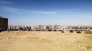
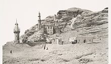
The Mokattam (Template:Lang-arz pronounced [elmoˈʔɑtˤ.tˤɑm], also spelled Muqattam), also known as the Mukattam Mountain or Hills, is the name of a range of hills and a suburb in them, located in southeastern Cairo, Egypt.[1][2]
Landform
The Arabic name Mokattam, which means cut off or broken off, refers to how the low range of hills is divided into three sections. The highest segment is a low mountain landform called Moqattam Mountain.[3] In the past the low mountain range was an important ancient Egyptian quarry site for limestone, used in the construction of temples and pyramids.[1][4]
Settlement
The hills are in the region of ancient Fustat, the new capital founded by 'Amr ibn al-'As after the Muslim conquest of Egypt in 642 CE.[5] In direct contrast to Zamalek, an affluent, nearby city, in Mokattam, residents living in the midst of the city's garbage-the garbage collection system for Cairo is located on the road that leads to the Coptic church in the quarry.[6][2] The Zabbaleen people, who are an integral part of collecting and processing Cairo's municipal solid waste, live in Manshiyat Naser, Garbage City, at the foot of the Mokattam Hills.[7]

Story
Mokattam is widely known in the Coptic Church, as it is believed to have moved up and down when the Coptic Pope Abraham of Alexandria performed a mass near it in order to prove to the Caliph that the Gospel is true when it says that if one has faith like a grain of mustard one can move a mountain. The name "Broken off Mountain" may be related to the fact that in the story the mountain breaks off from the underlying rock and rises up, before coming back down.[6]
See also
- City of the Dead, Islamic necropolis and cemetery
- List of types of limestone, ancient Egyptians quarried limestone in the hills
References
- ^ a b Kamel, Seif. "Al Mokattam Mountain: On top of Cairo". Archived from the original on 2009-01-05. Retrieved 2009-02-05.
{{cite web}}: Unknown parameter|deadurl=ignored (|url-status=suggested) (help) - ^ a b Kebede-Francis, Enku (October 25, 2010). Global Health Disparities: Closing the Gap Through Good Governance. Jones & Bartlett Publishers. p. 320. ISBN 9781449619343.
- ^ "Cave Church". Archived from the original on 2007-10-28. Retrieved 2016-11-14.
{{cite web}}: Unknown parameter|deadurl=ignored (|url-status=suggested) (help) - ^ Sir Philip de M. Grey Egerton, Bart, M.P., F.R.S., F.G.S., P. d. M. G. (1854). "Palichthyologic Notes. No. 8. On some Ichthyolites from the Nummulitic Limestone of the Mokattam Hills, near Cairo". Quarterly Journal of the Geological Society. 10: 374. doi:10.1144/GSL.JGS.1854.010.01-02.42.
{{cite journal}}: CS1 maint: multiple names: authors list (link) - ^ Rappoport, S. The Founding of Fostât -The Project Gutenberg EBook of History Of Egypt From 330 B.C. To The Present Time, Volume 11 (of 12),. Archived from the original on 14 November 2016. Retrieved 14 November 2016.
{{cite book}}: Unknown parameter|deadurl=ignored (|url-status=suggested) (help) - ^ a b BBC Newshour The Angel of Garbage City, October 11, 2014, 20:00 UTC.
- ^ Gauch, Sarah (January 6, 2003). "Egypt dumps 'garbage people'". The Christian Science Monitor. Archived from the original on March 22, 2009. Retrieved 2009-02-05.
{{cite web}}: Unknown parameter|deadurl=ignored (|url-status=suggested) (help)


