
National Register of Historic Places listings in Natrona County, Wyoming
(Redirected from National Register of Historic Places in Natrona County, Wyoming)

This is a list of the National Register of Historic Places listings in Natrona County, Wyoming.
It is intended to be a complete list of the properties and districts on the National Register of Historic Places in Natrona County, Wyoming, United States. The locations of National Register properties and districts for which the latitude and longitude coordinates are included below may be seen in a map.[1]
There are 39 properties and districts listed on the National Register in the county, 2 of which are National Historic Landmarks.
This National Park Service list is complete through NPS recent listings posted September 13, 2024.[2]
| Albany - Big Horn - Campbell - Carbon - Converse - Crook - Fremont - Goshen - Hot Springs - Johnson - Laramie - Lincoln - Natrona - Niobrara - Park - Platte - Sheridan - Sublette - Sweetwater - Teton - Uinta - Washakie - Weston |
Current listings
[edit]| [3] | Name on the Register | Image | Date listed[4] | Location | City or town | Description |
|---|---|---|---|---|---|---|
| 1 | Alcova Redoubt |  |
June 7, 2021 (#100006603) |
Address Restricted[5] | Alcova | |
| 2 | Archeological Site No. 48NA83 | |
May 13, 1994 (#94000440) |
Address Restricted[5] | Arminto | |
| 3 | Big Horn Hotel | December 18, 1978 (#78002831) |
Main Street 43°10′42″N 107°15′24″W / 43.178333°N 107.256667°W | Arminto | Built in 1906; moved in 1913; destroyed by fire in 1985. | |
| 4 | Bishop House | _2.JPG) |
March 12, 2001 (#01000270) |
818 East Second Street 42°50′56″N 106°18′53″W / 42.849003°N 106.314676°W | Casper | |
| 5 | Bridger Immigrant Road-Waltman Crossing |  |
January 17, 1975 (#75001905) |
49 miles west of Casper on U.S. Route 20 43°04′20″N 107°12′41″W / 43.072222°N 107.211389°W | Casper | |
| 6 | Casper Army Air Base |  |
August 3, 2001 (#01000789) |
8500 Fuller Street 42°53′31″N 106°50′34″W / 42.891944°N 106.842778°W | Casper | |
| 7 | Casper Buffalo Trap | |
June 25, 1974 (#74002027) |
Address Restricted[5] | Casper | |
| 8 | Casper Downtown Historic District |  |
October 17, 2016 (#16000732) |
Generally bounded by Midwest Avenue, West B and C, & Beech Streets 42°50′55″N 106°19′31″W / 42.848722°N 106.325186°W | Casper | |
| 9 | Casper Federal Building |  |
December 21, 1998 (#98001536) |
111 South Wolcott Street 42°50′59″N 106°19′22″W / 42.849722°N 106.322778°W | Casper | Now known as the Ewing T. Kerr Federal Building and U.S. Courthouse. |
| 10 | Casper Fire Department Station No. 1 |  |
November 4, 1993 (#93001187) |
302 South David Street 42°50′52″N 106°19′35″W / 42.847778°N 106.326389°W | Casper | |
| 11 | Casper Motor Company-Natrona Motor Company |  |
February 23, 1994 (#94000042) |
230 West Yellowstone Highway 42°50′55″N 106°19′36″W / 42.848611°N 106.326667°W | Casper | Currently the Lyric Theatre; formerly the Iris. |
| 12 | Chicago and Northwestern Railroad Depot |  |
January 7, 1988 (#87002296) |
35231 West Dakota Avenue 43°02′04″N 106°59′10″W / 43.034444°N 106.986111°W | Powder River | |
| 13 | Church of Saint Anthony |  |
January 30, 1997 (#96001631) |
604 South Center Street 42°50′37″N 106°19′29″W / 42.843611°N 106.324722°W | Casper | |
| 14 | Consolidated Royalty Building |  |
November 4, 1993 (#93001186) |
137-141 South Center Street 42°50′57″N 106°19′27″W / 42.849167°N 106.324167°W | Casper | |
| 15 | DUX Bessemer Bend Bridge |  |
February 22, 1985 (#85000428) |
County Road CN1-58 42°46′18″N 106°31′50″W / 42.771667°N 106.530556°W | Bessemer Bend | Replaced in 1997 |
| 16 | Elks Lodge No. 1353 |  |
January 30, 1997 (#96001632) |
108 East 7th Street 42°50′38″N 106°19′27″W / 42.843889°N 106.324167°W | Casper | |
| 17 | Fort Caspar |  |
August 12, 1971 (#71000887) |
14 Fort Caspar Road; also an area on the northern side of the fort along the Platte River 42°50′09″N 106°22′19″W / 42.835833°N 106.371944°W | Casper | Second set of boundaries represents a boundary increase |
| 18 | Grant Street Grocery and Market |  |
October 15, 2008 (#08001005) |
815 South Grant Street 42°50′30″N 107°19′02″W / 42.841667°N 107.317222°W | Casper | |
| 19 | Independence Rock |  |
October 15, 1966 (#66000757) |
60 miles southwest of Casper on Wyoming Highway 220 42°29′38″N 107°07′48″W / 42.493889°N 107.13°W | Casper | |
| 20 | Martin's Cove |  |
March 8, 1977 (#77001383) |
West of Casper 42°27′16″N 107°14′43″W / 42.454444°N 107.245278°W | Casper | |
| 21 | Masonic Temple |  |
August 24, 2005 (#05000926) |
105 North Center Street 42°51′01″N 106°19′27″W / 42.850278°N 106.324167°W | Casper | |
| 22 | Midwest Oil Company Hotel |  |
November 17, 1983 (#83004302) |
136 East 6th Street 42°50′41″N 106°19′25″W / 42.844722°N 106.323611°W | Casper | |
| 23 | Dean Morgan Junior High School |  |
May 3, 2016 (#16000229) |
1440 South Elm Street 42°50′09″N 106°19′46″W / 42.835852°N 106.329570°W | Casper | |
| 24 | Natrona County High School |  |
January 7, 1994 (#93001491) |
930 South Elm Street 42°50′36″N 106°19′43″W / 42.843333°N 106.328611°W | Casper | |
| 25 | North Casper Clubhouse |  |
February 18, 1994 (#94000043) |
1032 East L Street 42°51′43″N 106°18′42″W / 42.861944°N 106.311667°W | Casper | |
| 26 | Odd Fellows Building |  |
June 18, 2009 (#09000455) |
136 South Wolcott Street 42°50′58″N 106°19′26″W / 42.849578°N 106.323806°W | Casper | |
| 27 | Ohio Oil Company Building |  |
July 25, 2001 (#01000791) |
159 North Wolcott Street 42°51′04″N 106°19′22″W / 42.851111°N 106.322778°W | Casper | |
| 28 | Pathfinder Dam |  |
August 12, 1971 (#71000888) |
45 miles southwest of Casper 42°28′05″N 106°51′12″W / 42.468056°N 106.853333°W | Casper | Includes just the dam. |
| 29 | Pathfinder Dam Historic District | |
June 15, 2015 (#15000357) |
12 miles southwest of Alcova 42°28′05″N 106°51′13″W / 42.468056°N 106.8536°W | Alcova vicinity | Includes dam, operating facilities, and archaeological remains of construction camp. |
| 30 | Rialto Theater | ,_west_facade.jpg) |
February 11, 1993 (#93000037) |
102 East Second Street 42°50′55″N 106°19′09″W / 42.848611°N 106.319167°W | Casper | |
| 31 | Roosevelt School |  |
January 30, 1997 (#96001633) |
140 East K Street 42°51′59″N 106°19′25″W / 42.866389°N 106.323611°W | Casper | |
| 32 | South Wolcott Street Historic District |  |
November 23, 1988 (#88002609) |
Roughly bounded by S. Center St., E. 9th St., S. Wolcott St., E. 7th St., S. Beech St., and E. 13th St. 42°50′25″N 106°19′21″W / 42.840278°N 106.3225°W | Casper | |
| 33 | Split Rock, Twin Peaks |  |
December 22, 1976 (#76001959) |
Northwest of Muddy Gap 42°28′51″N 107°31′44″W / 42.480833°N 107.528889°W | Muddy Gap | |
| 34 | Stone Ranch Stage Station |  |
November 1, 1982 (#82001834) |
Northwest of Casper on U.S. Routes 20/26 42°57′44″N 106°38′56″W / 42.962222°N 106.648889°W | Casper | |
| 35 | Tom Sun Ranch |  |
October 15, 1966 (#66000753) |
6 miles west of Independence Rock on Wyoming Highway 220 42°26′40″N 107°14′36″W / 42.444444°N 107.243333°W | Independence Rock | |
| 36 | Teapot Rock |  |
December 30, 1974 (#74002028) |
Off U.S. Route 87 43°14′00″N 106°18′37″W / 43.233333°N 106.310278°W | Midwest | |
| 37 | Townsend Hotel |  |
November 25, 1983 (#83004303) |
115 North Center Street 42°50′56″N 106°19′27″W / 42.848889°N 106.324167°W | Casper | It was renovated and expanded for government use in 2008-2009 and is now known as the Townsend Justice Center[6] |
| 38 | Tribune Building |  |
February 18, 1994 (#94000041) |
216 East Second Street 42°50′56″N 106°19′22″W / 42.848889°N 106.322778°W | Casper | |
| 39 | Turner-Cottman Building |  |
December 1, 2015 (#15000856) |
120-130 West Second Street 42°50′55″N 106°19′33″W / 42.848684°N 106.325913°W | Casper | |
| 40 | Edness Kimball Wilkins No. 1 Site | |
August 10, 2015 (#15000520) |
Address Restricted | Evansville |
See also
[edit]Wikimedia Commons has media related to National Register of Historic Places in Natrona County, Wyoming.
- List of National Historic Landmarks in Wyoming
- National Register of Historic Places listings in Wyoming
References
[edit]- ^ The latitude and longitude information provided in this table was derived originally from the National Register Information System, which has been found to be fairly accurate for about 99% of listings. Some locations in this table may have been corrected to current GPS standards.
- ^ National Park Service, United States Department of the Interior, "National Register of Historic Places: Weekly List Actions", retrieved September 13, 2024.
- ^ Numbers represent an alphabetical ordering by significant words. Various colorings, defined here, differentiate National Historic Landmarks and historic districts from other NRHP buildings, structures, sites or objects.
- ^ The eight-digit number below each date is the number assigned to each location in the National Register Information System database, which can be viewed by clicking the number.
- ^ a b c Some listings on the NRHP are highly sensitive sites and may be subject to looting or vandalism. The NRHP lists this site as "Address Restricted."
- ^ Morton, Tom (2009-12-26). "Total transformation". Trib.com. Retrieved 2011-12-08.
| Topics | |
|---|---|
| Lists by state |
|
| Lists by insular areas | |
| Lists by associated state | |
| Other areas | |
| Related | |
Municipalities and communities of Natrona County, Wyoming, United States | ||
|---|---|---|
| City | 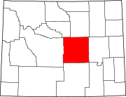 | |
| Towns | ||
| CDPs | ||
| Other communities | ||