
Ogawa, Saitama
This article needs additional citations for verification. (February 2017) |
Ogawa
小川町 | |
|---|---|
 Ogawa town office | |
 Flag  Seal | |
 Location of Ogawa in Saitama Prefecture | |
 Ogawa | |
| Coordinates: 36°3′24″N 139°15′42.6″E / 36.05667°N 139.261833°E | |
| Country | Japan |
| Region | Kantō |
| Prefecture | Saitama Prefecture |
| District | Hiki |
| Area | |
• Total | 60.36 km2 (23.31 sq mi) |
| Population (February 2016) | |
• Total | 30,972 |
| • Density | 513/km2 (1,330/sq mi) |
| Time zone | UTC+9 (Japan Standard Time) |
| - Tree | Zelkova serrata |
| - Flower | Adonis ramosa |
| - Bird | Japanese white-eye |
| Phone number | 0493-72-1221 |
| Address | 55 Otsuka, Ogawa-machi, Hiki-gun, Saitama-ken 355-0392 |
| Website | http://www.town.ogawa.saitama.jp/ |
Ogawa (小川町, Ogawa-machi) is a town in Saitama Prefecture, Japan. As of 1 February 2016[update], the town had an estimated population of 30,972, and a population density of 513 persons per km². Its total area is 60.36 km².
Geography
Ogawa is located in central Saitama Prefecture.
Surrounding municipalities
History
The village of Ogawa was created within Hiki District, Saitama with the establishment of the municipalities system on April 1, 1889. Ogawa annexed the neighboring villages of Okawa, Takezawa and Yawata on February 1, 1955. Tokigawa and Tamagawa merged to form the town of Tokigawa.[citation needed]
Economy
The town was traditionally famous for Japanese traditional papermaking (washi).[citation needed]
Education
Ogawa has six elementary schools, three junior high schools, and one high school.
-
 Takezawa Elementary School in Ogawa

Transportation
Railway
-
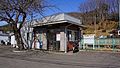 Takezawa Station in February 2017
 -
 Tōbu-Takezawa Station in February 2017


Highway
- Kan-Etsu Expressway – Ranzan-Ogawa IC
- National Route 254
External links
Wikimedia Commons has media related to Ogawa, Saitama.
- Official Website (in Japanese)
| Saitama |
| |||
|---|---|---|---|---|
| Core cities | ||||
| Special cities | ||||
| Cities | ||||
| Districts | ||||
| International | |
|---|---|
| National | |