
General Tinio
This article has multiple issues. Please help improve it or discuss these issues on the talk page. (Learn how and when to remove these messages)
|
General Tinio | |
|---|---|
 Welcome Arch | |
 Seal | |
 Map of Nueva Ecija with General Tinio highlighted | |
OpenStreetMap  | |
.svg) General Tinio Location within the Philippines | |
| Coordinates: 15°21′N 121°03′E / 15.35°N 121.05°E | |
| Country | Philippines |
| Region | Central Luzon |
| Province | Nueva Ecija |
| District | 4th district |
| Founded | 1921 |
| Named for | Manuel Tinio |
| Barangays | 13 (see Barangays) |
| Government | |
| • Type | Sangguniang Bayan |
| • Mayor | Engr. Isidro T. Pajarillaga |
| • Vice Mayor | Melvin S. Pascual |
| • Representative | Emerson D. Pascual |
| • Municipal Council | Members |
| • Electorate | 39,556 voters (2022) |
| Area | |
| • Total | 245.29 km2 (94.71 sq mi) |
| Elevation | 56 m (184 ft) |
| Highest elevation | 113 m (371 ft) |
| Lowest elevation | 32 m (105 ft) |
| Population (2020 census)[3] | |
| • Total | 55,925 |
| • Density | 230/km2 (590/sq mi) |
| • Households | 13,137 |
| Economy | |
| • Income class | 1st municipal income class |
| • Poverty incidence | 12.61 |
| • Revenue | ₱ 242.3 million (2020) |
| • Assets | ₱ 433.3 million (2020) |
| • Expenditure | ₱ 213.8 million (2020) |
| • Liabilities | ₱ 238 million (2020) |
| Service provider | |
| • Electricity | Nueva Ecija 2 Area 2 Electric Cooperative (NEECO 2 A2) |
| Time zone | UTC+8 (PST) |
| ZIP code | 3104 |
| PSGC | |
| IDD : area code | +63 (0)44 |
| Native languages | Southern Alta Tagalog Ilocano |
| Website | www |
General Tinio, officially the Municipality of General Tinio (Tagalog: Bayan ng Heneral Tinio, Ilocano: Ili ti Heneral Tinio), is a 1st class municipality in the province of Nueva Ecija, Philippines. According to the 2020 census, it has a population of 55,925 people.[3] It was known as Papaya until 1957.
The town is at the foot of the Sierra Madre Mountains, adjoining the Fort Magsaysay Army Reservation on the northeastern side.
History
[edit]According to the History and the Cultural Life of Papaya, Nueva Ecija,[5] during the Spanish regime, the place was a vast wilderness. The only inhabited part was the present-day Barrio of Rio Chico. However, every once in a while, some Spanish soldiers that are dispatched from their headquarters in San Isidro visit the place. Amongst the eight to ten soldiers who will visit, one or two will patrol the barrio. It was said that they feared that it would take long before they could find one another. They thought of a plan to have a permanent meeting place. They found a tall papaya tree with abundant fruit, which grew conspicuously in the place where the old Catholic Church now stands. They decided to have this tree as their meeting point whenever they patrolled the area. The said papaya tree served as a guide and their meeting place. Since then, this place has been known as Papaya.
Papaya was a sitio of Barrio Mapisong which was a barrio of Gapan. Barrio Mapisong, itself, became a town by a Royal Decree in May 1851[1] changing its name to Peñaranda - after a Spanish engineer Jose Maria Peñaranda. Papaya, thus, became one of its barrios.

On March 10, 1917, by virtue of Act 2711,[6] Barrio Papaya became a municipality and was listed among 27 municipalities of the Province of Nueva Ecija. On October 14, 1920, Governor General Francis Burton Harrison issued Executive Order No. 30 *separating Barrio Papaya, Barrio Rio Chico and Barrio Pias from the Town of Peñaranda to organize the independent town of Papaya *effective on January 1, 1921. This happened through the collaborative efforts of Capitan Mamerto Padolina who was then the Secretary of the Governor of the Province, Judge Segundo Bernardo and Francisco Padolina.
After the WWII, Congressman Celestino Juan sponsored a congressional act changing the name of Papaya to General Tinio in honor of General Manuel Tinio, a noble and prominent revolutionary leader against the Spaniards who hailed from the Nueva Ecija. The act was signed into law on June 20, 1957, as Republic Act No. 1665.[7] The new name of the town was inaugurated days later, on August 19, 1957.
Geography
[edit]Barangays
[edit]General Tinio is politically subdivided into 13 barangays. Each barangay consist of puroks and some have sitios.
- Padolina (Barangay 1)
- Concepcion (Barangay 2)
- Rio Chico (Barangay 3)
- Pias (Barangay 4)
- Nazareth (Barangay 5)
- Bago (Barangay 6)
- Poblacion West (Barangay 7)
- Poblacion Central (Barangay 8)
- San Pedro (Barangay 9)
- Sampaguita (Barangay 10)
- Poblacion East (Barangay 11)
- Pulong Matong (Barangay 12)
- Palale (Barangay 13)
Climate
[edit]| Climate data for General Tinio, Nueva Ecija | |||||||||||||
|---|---|---|---|---|---|---|---|---|---|---|---|---|---|
| Month | Jan | Feb | Mar | Apr | May | Jun | Jul | Aug | Sep | Oct | Nov | Dec | Year |
| Mean daily maximum °C (°F) | 29 (84) |
30 (86) |
31 (88) |
34 (93) |
33 (91) |
31 (88) |
30 (86) |
29 (84) |
29 (84) |
30 (86) |
30 (86) |
29 (84) |
30 (87) |
| Mean daily minimum °C (°F) | 20 (68) |
20 (68) |
20 (68) |
22 (72) |
24 (75) |
24 (75) |
24 (75) |
24 (75) |
24 (75) |
23 (73) |
22 (72) |
21 (70) |
22 (72) |
| Average precipitation mm (inches) | 4 (0.2) |
4 (0.2) |
5 (0.2) |
11 (0.4) |
66 (2.6) |
99 (3.9) |
127 (5.0) |
113 (4.4) |
99 (3.9) |
84 (3.3) |
35 (1.4) |
14 (0.6) |
661 (26.1) |
| Average rainy days | 2.2 | 1.9 | 3.2 | 5.3 | 16.1 | 20.8 | 23.5 | 22.8 | 22.2 | 16.5 | 8.9 | 3.5 | 146.9 |
| Source: Meteoblue[8] | |||||||||||||
Demographics
[edit]| Year | Pop. | ±% p.a. |
|---|---|---|
| 1939 | 7,517 | — |
| 1948 | 8,645 | +1.57% |
| 1960 | 14,925 | +4.65% |
| 1970 | 19,353 | +2.63% |
| 1975 | 21,088 | +1.74% |
| 1980 | 23,406 | +2.11% |
| 1990 | 29,491 | +2.34% |
| 1995 | 32,913 | +2.08% |
| 2000 | 35,352 | +1.54% |
| 2007 | 39,356 | +1.49% |
| 2010 | 42,634 | +2.95% |
| 2015 | 47,865 | +2.23% |
| 2020 | 55,925 | +3.11% |
| Source: Philippine Statistics Authority[9][10][11][12] | ||
Economy
[edit]Poverty incidence of General Tinio
5
10
15
20
2006
19.70 2009
15.69 2012
15.38 2015
14.92 2018
5.10 2021
12.61 Source: Philippine Statistics Authority[13][14][15][16][17][18][19][20] |
Farming is the livelihood of majority of the residents. Even though located at the foot of the Sierra Madre Mountain Ridges, the topography is generally plain ideal to agricultural products such as palay and vegetables. A number of poultry broiler contract growers are located in the municipality. Other industries include furniture and fixtures, backyard poultry, cattle and livestock, vegetable production and minor agricultural livelihoods like duck raising. "Ikmo" or betel leaves production is one dying symbol of the town. The practice of chewing betel leaves by the older generation was not adopted by the younger generation even though of its reported natural anti-cancer formula.
The remittances of numerous sons and daughters of Papaya abroad also help keep the economy of the town afloat. Papayanos can be relied to answer calls of assistance for the town's development.
Minalungao National Park is also one of the biggest attraction of the town catering to numerous visitors each day.
Government
[edit]Local government
[edit]The following have led the town from its birth in 1921 to what it had become today.[21]
| American Colonial Period (1898 - 1935) | ||
|---|---|---|
| Municipal President | Municipal Vice President | Term |
| Cristobal Castro Mangulabnan (appointed) | Vice Martin Ramos (appointed) | 1921–1922 |
| Getulio Bote, Sr. | Vice Martin Pajarillaga | 1922–1925 |
| Martin Pajarillaga | Vice Marcos Bote Sr. | 1925–1931 |
| Marcos Bote Sr. | Vice Daniel Padolina | 1931–1934 |
| Melquiades Ronquillo, Sr. | Vice Santiago Bolisay | 1934–1937 |
| Commonwealth Period (1935 - 1946) | ||
| Municipal Mayor | Municipal Vice Mayor | Term |
| Melquades Ronquillo, Sr. | Vice Damaso Bolisay | 1937–1940 |
| Getulio Bote | Vice Pedro Bulacan | 1940–1943 |
| Second Republic (Japanese Occupation 1943-1945) | ||
| Getulio Bote (under Japanese forces) | Vice Pedro Bulacan | 1943–1944 |
| Getulio Bote (transition to Commonwealth government) | Vice Angeles Bote | 1945 |
| Third Republic (1946 - 1972) | ||
| Gerardo Rivera | Vice Angeles Bote | 1946–1947 |
| Gerardo Rivera | Vice Diosdado Bote | 1948–1951 |
| Gerardo Rivera with | Victorino Bote | 1952–1955 |
| Bienvenido Bautista Abes | Vice Victorino Bote | 1956–1959 |
| Gerardo Rivera | Vice Banaag Leodones | 1960–1963 |
| Santos Quitua Bote | Vice Getulio Bote, Jr. | 1964–1967 |
| Mariano Ronquillo | Vice Manuel Domingo | January 1–15, 1968 |
| Manuel Domingo | Vice Perfecto M. Bote | 1968–1971 |
| Nicanor Bautista Aves | Vice Alfonso Pajimna | January 1– September 21, 1972 |
| Fourth Republic (1972 - 1986) | ||
| Nicanor Bautista Aves | Vice Alfonso Pajimna | September 21, 1972 -1980 |
| Nathaniel Bote, Jr. | Vice Venancio Bote | 1981–1986 |
| OIC Gerardo Rivera | Vice Antonio Abes | 1986–1988 |
| Fifth Republic (1986 - Present) | ||
| Placido Maducdoc Calma | Vice Bernardino R. Abes | 1988–1995 |
| Placido Maducdoc Calma | Vice Elsa Bote | 1995–1998 |
| Placido Maducdoc Calma | Vice Bernardino R. Abes | 1998–2004 |
| Isidro Tinio Pajarillaga | Vice Indira P. Dayupay | 2004–2007 |
| Virgilio Abes Bote | Vice Marcelo Bote Abes | 2007–2010 |
| Virgilio Abes Bote | Vice Engr. Ferdinand P. Bote | 2010–2016 |
| Engr. Ferdinand P. Bote | Vice Atty. Melvin Santiago Pascual | 2016– July 3, 2018 |
| Atty. Melvin Santiago Pascual | Vice Anna Rouselle B Busalpa | July 4, 2018-2019 |
| Isidro Tinio Pajarillaga | Vice Atty. Melvin Santiago Pascual | 2019–present |
Culture
[edit]Roman Catholic is the most prevalent religion, with Iglesia ni Cristo, IEMELIF, Baptist, Methodist, and others attracting its own followers. The town's patron saint, the Santo Cristo or the Holy Cross is being feted every May.
The town is best known for having the most number of brass bands in the Philippines with 15 organized bands. These bands are sought after to enhance entertainment ambience in fiestas and other traditional rites such as wakes. The Family band is the most popular one and have produced champions in majorette exhibition, solo flute competition, solo clarinet competition, solo trumpet competition, French horn competition, etc., in national brass band competitions.
The town also has other places of interest notably Minalungao National Park which is a favorite swimming destinations in summer, specially during Black Saturday when it is usually filled with local bathers and visitors. Minalungao, literally meaning "mine of gold in a cave", has several caves which can explored. The river also has a portion where a stone ledge located about 15 meters high from the river can be used as spring board.
Papaya Festival is also celebrated coincide with its Foundation Anniversary, Parade of different school students around the town wearing colourful costume inspired by the fruits Papaya which this town got its name until it was change to General Tinio
Gallery
[edit]-
 Town hall
 -
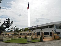 Sports center
 -
 Old Santo Cristo Parish Church
 -
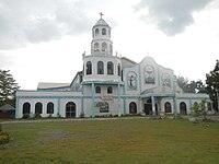 New Holy Cross Parish Church
 -
 Public market
 -
 Cory Aquino memorial
 -

-
 The Upper Tabuating Dam at Brgy. Nazareth


See also
[edit]References
[edit]- ^ Municipality of General Tinio | (DILG)
- ^ "2015 Census of Population, Report No. 3 – Population, Land Area, and Population Density" (PDF). Philippine Statistics Authority. Quezon City, Philippines. August 2016. ISSN 0117-1453. Archived (PDF) from the original on May 25, 2021. Retrieved July 16, 2021.
- ^ a b Census of Population (2020). "Region III (Central Luzon)". Total Population by Province, City, Municipality and Barangay. Philippine Statistics Authority. Retrieved 8 July 2021.
- ^ "PSA Releases the 2021 City and Municipal Level Poverty Estimates". Philippine Statistics Authority. 2 April 2024. Retrieved 28 April 2024.
- ^ Bal, Graciano P.; Pajimna, Conrado P.; Mangulabnan, Sulpicio B.; Abesamis, Guillermo B; Lustre, Maximo; Pajarillaga, Celso B; Abesamis, Filipinas P. (1952). "Papaya, Nueva Ecija Historical Data Papers from the Collections of the National Memory Project". National Historical Commission of the Philippines. Retrieved 2024-09-02.
{{cite web}}: CS1 maint: url-status (link) - ^ Harrison, Francis Burton (1917) [March 10, 1917]. "Act No. 2711 - The Official Gazette of the Republic of the Philippines". Official Gazette of the Republic of the Philippines. Retrieved September 2, 2024.
{{cite web}}: CS1 maint: url-status (link) - ^ "An Act Changing the Name of the Municipality of Papaya in the Province of Nueva Ecija to General Tinio". LawPH.com. Retrieved 2011-04-12.
- ^ "General Tinio: Average Temperatures and Rainfall". Meteoblue. Retrieved 4 May 2020.
- ^ Census of Population (2015). "Region III (Central Luzon)". Total Population by Province, City, Municipality and Barangay. Philippine Statistics Authority. Retrieved 20 June 2016.
- ^ Census of Population and Housing (2010). "Region III (Central Luzon)" (PDF). Total Population by Province, City, Municipality and Barangay. National Statistics Office. Retrieved 29 June 2016.
- ^ Censuses of Population (1903–2007). "Region III (Central Luzon)". Table 1. Population Enumerated in Various Censuses by Province/Highly Urbanized City: 1903 to 2007. National Statistics Office.
- ^ "Province of Nueva Ecija". Municipality Population Data. Local Water Utilities Administration Research Division. Retrieved 17 December 2016.
- ^ "Poverty incidence (PI):". Philippine Statistics Authority. Retrieved December 28, 2020.
- ^ "Estimation of Local Poverty in the Philippines" (PDF). Philippine Statistics Authority. 29 November 2005.
- ^ "2003 City and Municipal Level Poverty Estimates" (PDF). Philippine Statistics Authority. 23 March 2009.
- ^ "City and Municipal Level Poverty Estimates; 2006 and 2009" (PDF). Philippine Statistics Authority. 3 August 2012.
- ^ "2012 Municipal and City Level Poverty Estimates" (PDF). Philippine Statistics Authority. 31 May 2016.
- ^ "Municipal and City Level Small Area Poverty Estimates; 2009, 2012 and 2015". Philippine Statistics Authority. 10 July 2019.
- ^ "PSA Releases the 2018 Municipal and City Level Poverty Estimates". Philippine Statistics Authority. 15 December 2021. Retrieved 22 January 2022.
- ^ "PSA Releases the 2021 City and Municipal Level Poverty Estimates". Philippine Statistics Authority. 2 April 2024. Retrieved 28 April 2024.
- ^ "Elected Officials of General Tinio 2013-2016". Generaltinio.gov.ph. 2010-07-12. Retrieved 2016-11-23.
External links
[edit]Places adjacent to General Tinio | ||||||||||||||||
|---|---|---|---|---|---|---|---|---|---|---|---|---|---|---|---|---|
| ||||||||||||||||
| Municipalities | |
|---|---|
| Component cities | |