
Payne County, Oklahoma
Payne County | |
|---|---|
 Seal | |
 Location within the U.S. state of Oklahoma | |
 Oklahoma's location within the U.S. | |
| Coordinates: 36°05′N 96°58′W / 36.08°N 96.97°W | |
| Country | |
| State | |
| Founded | 1907 |
| Named for | Capt. David L. Payne |
| Seat | Stillwater |
| Largest city | Stillwater |
| Area | |
| • Total | 697 sq mi (1,810 km2) |
| • Land | 686 sq mi (1,780 km2) |
| Population (2000) | |
| • Total | 68,190 |
| • Density | 108/sq mi (42/km2) |
| Time zone | UTC−6 (Central) |
| • Summer (DST) | UTC−5 (CDT) |
| Congressional district | 3rd |
| Website | www |

Payne County is a county in the U.S. state of Oklahoma. The population as of 2009 was 79,727[1]. Its county seat is StillwaterTemplate:GR, and the county is named for Capt. David L. Payne. The county lies northeast of the Oklahoma City metropolitan area though many consider it an extension of the Oklahoma City metro area due to commuter patterns and other indicators.
Geography
According to the U.S. Census Bureau, the county has a total area of 697 square miles (1,806 km²), of which, 686 square miles (1,778 km²) of it is land and 11 square miles (28 km²) of it (1.55%) is water.
Adjacent counties
- Noble County (north)
- Pawnee County (northeast)
- Creek County (east)
- Lincoln County (south)
- Logan County (southwest)
Demographics
As of the censusTemplate:GR of 2000, there were 68,190 people, 26,680 households, and 15,314 families residing in the county. The population density was 99 people per square mile (38/km²). There were 29,326 housing units at an average density of 43 per square mile (16/km²). The racial makeup of the county was 84.33% White, 3.63% Black or African American, 4.58% Native American, 3.00% Asian, 0.04% Pacific Islander, 0.77% from other races, and 3.64% from two or more races. 2.15% of the population were Hispanic or Latino of any race.
There were 26,680 households out of which 25.90% had children under the age of 18 living with them, 45.60% were married couples living together, 8.30% had a female householder with no husband present, and 42.60% were non-families. 30.10% of all households were made up of individuals and 8.10% had someone living alone who was 65 years of age or older. The average household size was 2.29 and the average family size was 2.90.
In the county, the population was spread out with 19.60% under the age of 18, 25.90% from 18 to 24, 26.20% from 25 to 44, 17.60% from 45 to 64, and 10.80% who were 65 years of age or older. The median age was 28 years. For every 100 females there were 103.30 males. For every 100 females age 18 and over, there were 102.60 males.
The median income for a household in the county was $28,733, and the median income for a family was $40,823. Males had a median income of $31,132 versus $21,113 for females. The per capita income for the county was $15,983. About 10.80% of families and 20.30% of the population were below the poverty line, including 16.00% of those under age 18 and 8.50% of those age 65 or over.
Cities and towns
Education
Educational entities located in Payne County include:
- Oklahoma Department of Career and Technology Education
- Oklahoma State University-Stillwater
- Northern Oklahoma College
NRHP sites
The following sites in Payne County are listed on the National Register of Historic Places:
|
|
Other landmarks include:
- Allen Williamson Bridge - Memorial bridge near Ripley, named after the Oklahoma Representative Allen Williamson.
References
External links
Municipalities and communities of Payne County, Oklahoma, United States | ||
|---|---|---|
| Cities | 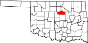 | |
| Towns | ||
| CDPs | ||
| Other communities | ||
| Ghost town | ||
| Footnotes | ‡This populated place also has portions in an adjacent county or counties | |