Presidente Figueiredo
Appearance
Presidente Figueiredo | |
|---|---|
 | |
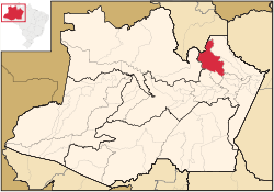
 Location of the municipality inside Amazonas | |
| Country | |
| Region | North |
| State | |
| Time zone | UTC−4 (BRT) |
| • Summer (DST) | UTC−4 (DST no longer used) |
Presidente Figueiredo is a municipality located in the Brazilian state of Amazonas. Its population was 30,978 (2013) and its area is 25,422 km².[1]
Conservation
The municipality contains the 374,700 hectares (926,000 acres) Caverna do Maroaga Environmental Protection Area, established in 1990.[2] It contains part of the 938,720 hectares (2,319,600 acres) Uatumã Biological Reserve, a strictly protected conservation unit created in 2002.[3] It also holds about 2% of the Rio Negro Left Bank Environmental Protection Area, a 611,008 hectares (1,509,830 acres) sustainable use conservation area created in 1995.[4]
References
- ^ "Amazonas » Presidente Figueiredo". IBGE. 2014. Retrieved 23 April 2014.
- ^ APA Caverna do Maroaga (Presidente Figueiredo) (in Portuguese), ISA: Instituto Socioambiental, retrieved 2016-10-20
- ^ Unidade de Conservação: Reserva Biológica do Uatumã (in Portuguese), MMA: Ministério do Meio Ambiente, retrieved 2016-04-18
- ^ APA Margem Esquerda do Rio Negro (in Portuguese), ISA: Instituto Socioambiental, retrieved 2016-06-28


