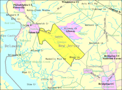
Quinton (CDP), New Jersey
Appearance
Quinton, New Jersey | |
|---|---|
 Quinton Township highlighted in Salem County. Inset map: Salem County highlighted in the State of New Jersey. | |
 Census Bureau map of Quinton Township, New Jersey | |
| Coordinates: 39°32′51″N 75°24′39″W / 39.547478°N 75.410915°W[1][2] | |
| Country | |
| State | |
| County | Salem |
| Township | Quinton |
| Area | |
| • Total | 0.908 sq mi (2.354 km2) |
| • Land | 0.885 sq mi (2.293 km2) |
| • Water | 0.023 sq mi (0.061 km2) 2.57% |
| Elevation | 23 ft (7 m) |
| Population | |
| • Total | 588 |
| • Density | 664.1/sq mi (256.4/km2) |
| Time zone | UTC-5 (Eastern (EST)) |
| • Summer (DST) | UTC-4 (Eastern (EDT)) |
| ZIP code | 08072[5] |
| Area code | 856 |
| FIPS code | 3461440[1][6] |
| GNIS feature ID | 02584021[1][7] |
Quinton is an unincorporated community and census-designated place (CDP) located within Quinton Township, in Salem County, New Jersey, United States.[8][9][10][11] As of the 2010 United States Census, the CDP's population was 1,402.[4]
Quinton CDP and Quinton Township are not coextensive, with the CDP covering 3.7% of the 24.588 miles (39.571 km) of the township as a whole.[8]
Geography
According to the United States Census Bureau, Quinton CDP had a total area of 0.908 square miles (2.354 km2), including 0.885 square miles (2.293 km2) of land and 0.023 square miles (0.061 km2) of water (2.57%).[1][2]
Demographics
Census 2010
References
- ^ a b c d e Gazetteer of New Jersey Places, United States Census Bureau. Accessed July 21, 2016.
- ^ a b US Gazetteer files: 2010, 2000, and 1990, United States Census Bureau. Accessed September 4, 2014.
- ^ U.S. Geological Survey Geographic Names Information System: Quinton Census Designated Place, Geographic Names Information System. Accessed February 10, 2013.
- ^ a b DP-1 - Profile of General Population and Housing Characteristics: 2010 Demographic Profile Data for Quinton CDP, New Jersey, United States Census Bureau. Accessed February 10, 2013.
- ^ Look Up a ZIP Code for Quinton, NJ, United States Postal Service. Accessed February 10, 2013.
- ^ American FactFinder, United States Census Bureau. Accessed September 4, 2014.
- ^ US Board on Geographic Names, United States Geological Survey. Accessed September 4, 2014.
- ^ a b GCT-PH1 - Population, Housing Units, Area, and Density: 2010 - County -- County Subdivision and Place from the 2010 Census Summary File 1 for Salem County, New Jersey, United States Census Bureau. Accessed February 10, 2013.
- ^ 2006-2010 American Community Survey Geography for New Jersey, United States Census Bureau. Accessed February 10, 2013.
- ^ New Jersey: 2010 - Population and Housing Unit Counts - 2010 Census of Population and Housing (CPH-2-32), United States Census Bureau, August 2012. Accessed February 10, 2013.
- ^ Locality Search, State of New Jersey. Accessed April 19, 2015.


