RAF Lindley
RAF Lindley | |||||||||||||||||||
|---|---|---|---|---|---|---|---|---|---|---|---|---|---|---|---|---|---|---|---|
| Summary | |||||||||||||||||||
| Airport type | Royal Air Force station | ||||||||||||||||||
| Owner | Air Ministry | ||||||||||||||||||
| Operator | Royal Air Force | ||||||||||||||||||
| Location | Higham on the Hill, Leicestershire | ||||||||||||||||||
| Built | 1940 | ||||||||||||||||||
| In use | 1940-1946 | ||||||||||||||||||
| Elevation AMSL | 328 ft / 100 m | ||||||||||||||||||
| Coordinates | 52°33′42″N 001°26′50″W / 52.56167°N 1.44722°W | ||||||||||||||||||
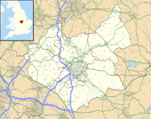
| Map | |||||||||||||||||||
| Runways | |||||||||||||||||||
| |||||||||||||||||||
Royal Air Force station or more simply RAF Lindley is a former Royal Air Force station which was located 8.1 miles (13.0 km) south east of Polesworth, Warwickshire, England.[1]
The airfield opened 1943 before closing in 1946.[2]
History
The first unit to use the airfield was No. 1513 Beam Approach Training Flight RAF (BAT Flt) flying the Airspeed Oxford based at RAF Bramcote, RAF Bitteswell and Lindley between 31 October 1942 and 13 May 1946.[3] From 7 February 1943 until 27 March 1943 No. 18 (Polish) Operational Training Unit RAF used the airfield as a satellite from RAF Bramcote flying Avro Ansons, Fairey Battles and Vickers Wellingtons [3] but the airfield was transferred to RAF Transport Command on 25 June 1943 and was home to No.105 Operational Training Unit flying Vickers Wellingtons and Douglas Dakotas until 21 November 1945. However the unit was renamed No. 1381 (Transport) Conversion Unit before moving to RAF Desborough on 10 August 1943.
United States Army use
The airfield was used by the Air Echelon of 250th Field Artillery, United States Army, with the Piper L-4 Cub, 'Grasshopper' between March and June 1944 before 30 November 1945 when the airfield was placed on care and maintenance.
Current use
The Motor Industry Research Association (MIRA) started using the airfield from October 1948[1] two years after it was founded.[4]
References
- ^ a b "Lindley/Nuneaton". Control Towers. Retrieved 2 April 2012.
- ^ "Lindley/Nuneaton". Airfields of Britain Conservation Trust. Retrieved 1 April 2012.
- ^ a b "Military flying units in the south west Midlands". Aviation Archaeology. Retrieved 2 April 2012.
- ^ "MIRA Heritage". MIRA. Retrieved 2 April 2012.


