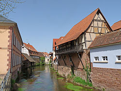
Sauer (Rhine)
Appearance
| Sauer | |
|---|---|
 | |
 | |
| Physical characteristics | |
| Source | |
| • location | Palatine Forest |
| Mouth | |
• location | Rhine |
| Length | ±70 km (43 mi) |
The Sauer is a river in France (Alsace) and Germany (Rhineland-Palatinate). A left tributary of the river Rhine, its total length is about 70 kilometres (43 mi). Its upper course, in Germany, is called Saarbach. Its source is in the Palatinate forest, near the French border, south of Pirmasens. It flows into France near Schœnau, and continues through Wœrth and north of Haguenau. It flows into the Rhine in Seltz, opposite the mouth of the Murg.
Tributaries
References

