
Sint-Katelijne-Waver
This article needs additional citations for verification. (January 2013) |
Sint-Katelijne-Waver | |
|---|---|
 | |
 Flag  Coat of arms | |
Location of Sint-Katelijne-Waver  | |
| Country | |
| Community | Flemish Community |
| Region | Flemish Region |
| Province | Antwerp |
| Arrondissement | Mechelen |
| Government | |
| • Mayor | Kristof Sels (NVA) |
| • Governing party/ies | CD&V/N-VA, independent |
| Area | |
| • Total | 36.16 km2 (13.96 sq mi) |
| Population (2018-01-01)[1] | |
| • Total | 20,870 |
| • Density | 580/km2 (1,500/sq mi) |
| Postal codes | 2860, 2861 |
| NIS code | 12035 |
| Area codes | 015, 03 |
| Website | www.sint-katelijne-waver.be |
Sint-Katelijne-Waver (Dutch pronunciation: [sɪnt kɑtəˌlɛi̯nə ˈʋaːvər], old spelling: Kathelijne-Waver, French Wavre-Sainte-Catherine) is a municipality located in the Belgian province of Antwerp. The municipality comprises the towns of Onze-Lieve-Vrouw-Waver and Sint-Katelijne-Waver proper. On January 1, 2006 Sint-Katelijne-Waver had a total population of 19,577. The total area is 36.12 km² which gives a population density of 542 inhabitants per km². Roosendael, a ruined relic of a cistercian abbey is situated here and host today a youth and touristic centre with pleasant walkways.
Economic activities
Sint-Katelijne-Waver is a centre for market gardening and hosts a lot of greenhouses. The Mechelse Veilingen [2] in Sint-Katelijne-Waver is the largest co-operative vegetable auction in Europe.
Pictures
-
 Leliestraat
 -
 Town hall
 -
 Church
 -
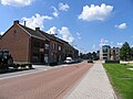
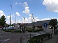
 Town centre


References
- ^ "Wettelijke Bevolking per gemeente op 1 januari 2018". Statbel. Retrieved 9 March 2019.
- ^ http://www.mv.be
External links
 Media related to Sint-Katelijne-Waver at Wikimedia Commons
- Official website - Available only in Dutch
Places adjacent to Sint-Katelijne-Waver | |
|---|---|

This Antwerp Province location article is a stub. You can help Wikipedia by expanding it. |