
South Savo
This article has multiple issues. Please help improve it or discuss these issues on the talk page. (Learn how and when to remove these template messages)
|
Southern Savonia
Etelä-Savo Etelä-Savon maakunta landskapet Södra Savolax | |
|---|---|
 Coat of arms | |
 Etelä-Savo on a map of Finland | |
| Coordinates: 62°0′N 27°30′E / 62.000°N 27.500°E | |
| Country | Finland |
| Historical province | Savonia |
| Area | |
| • Total | 18,768.33 km2 (7,246.49 sq mi) |
| Population (2013) | |
| • Total | 152,518 |
| • Density | 8.1/km2 (21/sq mi) |
| ISO 3166 code | FI-04 |
| NUTS | 131 |
| Regional bird | Golden oriole |
| Regional fish | Vendace |
| Regional flower | Water lily |
| Website | esavo.fi |
Southern Savonia or, officially, Etelä-Savo[1] (Finnish: Etelä-Savo; Swedish: Södra Savolax) is a region in the south-east of Finland. It borders the regions of Pohjois-Savo, North Karelia, South Karelia, Päijät-Häme, and Central Finland. The total area of Southern Savonia is 18,768.33 km2 (7,246.5 sq mi), with a population of 153,738 (2011).
Southern Savonia is located in the heart of the Finnish lake district, and contains Lake Saimaa, the largest lake in Finland. The two major towns in the region are Mikkeli and Savonlinna.
Historical provinces
For history, geography and culture see: Savonia
Municipalities
Southern Savonia includes 14 municipalities listed below (towns marked in bold).
Politics
Results of the Finnish parliamentary election, 2011 in Southern Savonia:
- Centre Party 26.8%
- Social Democratic Party 24.0%
- True Finns 20.5%
- National Coalition Party 14.1%
- Green League 7.5%
- Christian Democrats 4.5%
- Left Alliance 2.2%
Gallery
-
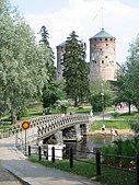 Olavinlinna castle in Savonlinna
 -
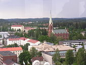 A general view of Mikkeli with the neogothic cathedral
 -
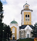 The world's largest wooden church in Kerimäki
 -
 Valamo Orthodox Monastery in Heinävesi
 -
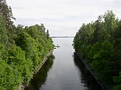 Oravi Canal, Savonlinna
 -
 Pertunmaa church
 -
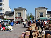 Marketplace in Mikkeli
 -
 Savonlinna Town Hall
 -
 Heinävesi church
 -
 Rock paintings in Ristiina
 -
 A view from Linnavuori, Sulkava
 -
 Juva church
 -
 Inwaters transport in Haukivesi
 -
 Rantasalmi church
 -
 Punkaharju esker
 -
 A casino building in Savonlinna
 -
 An annual church boat competition in Sulkava
 -
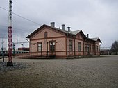
 Huutokoski railway station
 -
 Lake Sarkavesi, Mäntyharju: a typical Savo landscape
 -
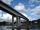 Saimaansilta bridge, Puumala
 -
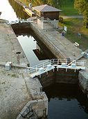 Karvio canal, Heinävesi
 -
 Pieksämäki railway station
 -
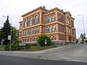
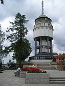 Mikkeli water tower


References
External links
Wikimedia Commons has media related to Southern Savonia.
- Southern Savonia (official site).
| Regions |  | |
|---|---|---|
| Former regions | ||