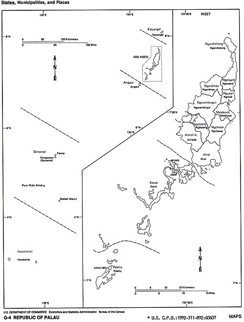
States of Palau
Appearance
 |
|---|
Palau is divided into sixteen administrative regions, called states (the still separately listed Rock Islands did originally not belong to any state, but now belong to the state of Koror).
| State | Capital | Area (km²) |
Population (Census 2005) |
|---|---|---|---|
| North of Babeldaob | |||
| Kayangel | 3 | 188 | |
| Babeldaob | |||
| Mongami | 52 | 270 | |
| Ngetkib | 44 | 2 723 | |
| Melekeok | 28 | 391 | |
| Ulimang | 36 | 581 | |
| Mengellang | 10 | 488 | |
| Urdmang | 47 | 166 | |
| Imeong | 65 | 317 | |
| Ngereklmadel | 47 | 464 | |
| Ngersuul | 41 | 254 | |
| Ngerkeai | 26 | 223 | |
| Southwest of Babeldaob | |||
| Ngaramasch | 8 | 320 | |
| Koror | 18 | 12 676 | |
| Kloulklubed | 13 | 702 | |
| Rock Islands (also known as Chelbacheb) | – | 47 | – |
| Southwest Islands | |||
| Hatohobei | 3 | 44 | |
| Dongosaru | 3 | 100 | |

