User:Mortenbuchwald/sandbox
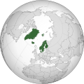
The Scandinavian Triangle (sometimes Nordic Triangle) is a megalopolis in Southern Scandinavia in Northern Europe with the capital of each of the Scandinavian countries delineating a triangular land area covering the Southeastern corner of Norway, most parts of Svealand and all of Götaland in Sweden, and Zealand in Denmark. The Nordic Council of Ministers first used the term in its 'Nordic Infrastructure' publication from 1997[1]. Today the term is still used in connection with transport and infrastructure[2] and also often used in relation to tourism (The Golden Triangle of Scandinavia) where visitors get a chance to visit all three Scandinavian capitals[3][4].
Scandinavian Triangle
Nordic Triangle | |
|---|---|
| Scandinavia | Denmark Norway Sweden |
| Regions | Region Zealand Capital Region of Denmark Skåne County Halland County Kronoberg County Blekinge County Kalmar County Jönköping County Västra Götaland County Östergötland County Södermanland County Stockholm County Uppsala County Västmanland County Örebro County Värmland County Østfold Akershus Oslo |
| Largest cities | Stockholm Copenhagen Oslo Gothenburg Malmö |
| Other municipalities | Uppsala Linköping Västerås Örebro Helsingborg Norrköping Jönköping Bærum Lund Borås Huddinge Frederiksberg Eskilstuna Nacka Halmstad |
| Area | |
| • Land | 155,948 km2 (60,212 sq mi) |
| Population (2018) | |
| • Megalopolis | 12,834,909 |
| • Density | 82.30/km2 (213.2/sq mi) |
| • Urban | 8,765,556 |
| Demonym | Scandinavian |
Definition
[edit]Geography
[edit]The Scandinavian Triangle only makes up 1/4 of the total landmass of the Nordic countries (excluding Greenland) yet more than half of the population. The Nordic region's three busiest airports by passenger number are to be found in each of the capitals, respectively.
Demography
[edit]Regions
[edit]The total population of the Scandinavian Triangle is 12,834,909 spread across 19 regions, including 307 municipalities, covering a total of 155,948 km2. Population density stands at 82.30 inhabitants/km2.
| Region | Population | Area | Population density | Municipalities |
|---|---|---|---|---|
| Region Zealand | 835,024 | 7,273 | 114.81 | 17 |
| Capital Region of Denmark | 1,822,659 | 2,568 | 709.76 | 29 |
| Skåne County | 1,344,689 | 11,027 | 121.95 | 33 |
| Halland County | 324,825 | 5,454 | 59.56 | 6 |
| Kronoberg County | 197,519 | 8,466 | 23.33 | 8 |
| Blekinge County | 159,371 | 3,039 | 52.44 | 5 |
| Kalmar County | 243,536 | 11,218 | 21.71 | 12 |
| Jönköping County | 357,237 | 10,495 | 34.04 | 13 |
| Västra Götaland County | 1,690,782 | 25,247 | 66.97 | 49 |
| Östergötland County | 457,496 | 9,979 | 45.85 | 13 |
| Södermanland County | 291,341 | 5,619 | 51.85 | 9 |
| Stockholm County | 2,308,143 | 6,519 | 354.06 | 26 |
| Uppsala County | 368,971 | 8,207 | 44.96 | 8 |
| Västmanland County | 271,095 | 5,146 | 52.68 | 10 |
| Örebro County | 298,907 | 8,546 | 34.98 | 12 |
| Värmland County | 280,399 | 17,591 | 15.94 | 16 |
| Østfold | 295,420 | 4,182 | 70.64 | 18 |
| Akershus | 614,026 | 4,918 | 124.85 | 22 |
| Oslo | 673,469 | 454 | 1,483.41 | 1 |
Functional urban areas
[edit]OECD has defined the following functional urban areas (FUAs) for the Scandinavian Triangle. According to this definition, only including urban areas with a population of at least 50,000 inhabitants and a city core with a density of at least 1,500 inhabitants/km2, the total population living in functional urban areas in the Scandinavian Triangle stands at 8,765,556[5].
| Name FUA | Class type | Total population |
|---|---|---|
| Stockholm | Large metropolitan areas | 2,213,757 |
| Copenhagen | Large metropolitan areas | 2,128,512 |
| Oslo | Metropolitan areas | 1,332,173 |
| Gothenburg | Metropolitan areas | 951,784 |
| Malmö | Metropolitan areas | 720,823 |
| Uppsala | Medium-sized urban areas | 228,736 |
| Linköping | Small urban areas | 199,576 |
| Örebro | Small urban areas | 196,664 |
| Västerås | Small urban areas | 191,141 |
| Helsingborg | Small urban areas | 190,597 |
| Norrköping | Small urban areas | 154,412 |
| Jönköping | Small urban areas | 150,359 |
| Borås | Small urban areas | 107,022 |
See also
[edit]References
[edit]External links
[edit]- ^ "Nordic Infrastructure". Google. Nordic Council of Ministers. Retrieved 20 March 2018.
- ^ "The Bothnian Corridor" (PDF). Bothnian Corridor. Bothnian Corridor. Retrieved 22 March 2018.
- ^ "THE GOLDEN TRIANGLE OF SCANDINAVIA". Nordic Visitor. Nordic Visitor. Retrieved 20 March 2018.
- ^ "How to plan a Scandinavia Triangle trip". ACP Rail Blog. ACP Rail International. Retrieved 20 March 2018.
- ^ "State of the Nordic Region 2016". Nordregio. Nordregio. Retrieved 22 March 2018.


