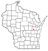
Wakefield, Wisconsin
Appearance
Wakefield, Wisconsin | |
|---|---|
 Location of Wakefield, Wisconsin | |
| Coordinates: 44°15′56.33″N 88°32′13.52″W / 44.2656472°N 88.5370889°W | |
| Country | United States |
| State | Wisconsin |
| County | Outagamie |
| Elevation | 892 ft (272 m) |
| Time zone | UTC-6 (Central (CST)) |
| • Summer (DST) | UTC-5 (CDT) |
| ZIP Codes | 54914 |
| Area code | (920) |
Wakefield is a former unincorporated community in Outagamie County, Wisconsin, United States. It is located in the town of Greenville.
Wakefield had a post office from 1852 to 1879,[2] on land that is now occupied by Appleton International Airport.
Geography
Wakefield is located at 44°15′56.33″N 88°32′13.52″W / 44.2656472°N 88.5370889°W (44.265647, -88.537089)[3] and has an elevation of 892 feet (272m).
References
- ^ "US Board on Geographic Names". United States Geological Survey. 2007-10-25. Retrieved 2008-01-31.
- ^ http://www.postalhistory.com/postoffices.asp?task=display&state=WI&county=Outagamie&searchtext=&pagenum=3
- ^ "US Gazetteer files: 2010, 2000, and 1990". United States Census Bureau. 2011-02-12. Retrieved 2011-04-23.

