
Westerlo
Westerlo | |
|---|---|
 Town Hall of Westerlo | |
 Flag  Coat of arms | |
Location of Westerlo  | |
 Westerlo Location in Belgium
Westerlo municipality in the province of Antwerp  | |
| Coordinates: 51°05′N 04°55′E / 51.083°N 4.917°E | |
| Country | |
| Community | Flemish Community |
| Region | Flemish Region |
| Province | Antwerp |
| Arrondissement | Turnhout |
| Government | |
| • Mayor | Guy Van Hirtum (CD&V) |
| • Governing party/ies | CD&V |
| Area | |
| • Total | 55.47 km2 (21.42 sq mi) |
| Population (2018-01-01)[1] | |
| • Total | 24,884 |
| • Density | 450/km2 (1,200/sq mi) |
| Postal codes | 2260 |
| NIS code | 13049 |
| Area codes | 014 - 015 - 016 |
| Website | www.westerlo.be |
Westerlo (Dutch pronunciation: [ˈʋɛstərloː]) is a municipality located in the Belgian province of Antwerp. The municipality comprises seven towns:
- Westerlo centrum (population 3,831)
- Oevel (population 3,454)
- Tongerlo (population 4,679)
- Heultje (population 3,973)
- Voortkapel (population 2,408)
- Oosterwijk (population 2,350)
- Zoerle-Parwijs (population 2,202)
On January 1, 2006 Westerlo had a total population of 22,896. The total area is 55.13 km² which gives a population density of 415 inhabitants per km².
Places of interest
Tongerlo Abbey contains a very old and fine copy of Leonardo da Vinci's The Last Supper. It is also known as home of the Tongerlo Abbey beer, but this is no longer brewed at the abbey.
Gallery
-
 Westerlo, townhall
 -
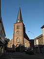 Westerlo, church
 -
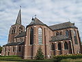
 Tongerlo, church
 -
 Oevel, church
 -
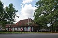 Hof van Overwijs


See also
References
- ^ "Wettelijke Bevolking per gemeente op 1 januari 2018". Statbel. Retrieved 9 March 2019.
External links
 Media related to Westerlo at Wikimedia Commons
- Official website Template:Nl icon

| International | |
|---|---|
| National | |
| Geographic | |
| Other | |
This Antwerp Province location article is a stub. You can help Wikipedia by expanding it. |