Reao
 NASA picture of Reao Atoll | |
| Geography | |
|---|---|
| Location | Pacific Ocean |
| Coordinates | 18°28′11″S 136°26′33″W / 18.46972°S 136.44250°W |
| Archipelago | Tuamotus |
| Area | 34 km2 (13 sq mi) (lagoon) 9 km2 (3 sq mi) (above water) |
| Length | 24.5 km (15.22 mi) |
| Width | 5 km (3.1 mi) |
| Administration | |
France | |
| Overseas collectivity | French Polynesia |
| Administrative subdivision | Tuamotus |
| Commune | Reao |
| Demographics | |
| Population | 351[1] (2017) |
Reao | |
|---|---|
 | |
| Coordinates: 18°28′11″S 136°26′33″W / 18.4697°S 136.4426°W | |
| Country | France |
| Overseas collectivity | French Polynesia |
| Subdivision | Îles Tuamotu-Gambier |
| Area 1 | 18 km2 (7 sq mi) |
| Population (2017)[1] | 587 |
| • Density | 33/km2 (84/sq mi) |
| Time zone | UTC−10:00 |
| INSEE/Postal code | 98742 / |
| Elevation | 0 m (0 ft) |
| 1 French Land Register data, which excludes lakes, ponds, glaciers > 1 km2 (0.386 sq mi or 247 acres) and river estuaries. | |
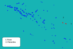
Reao or Natūpe is an atoll in the eastern expanses of the Tuamotu group in French Polynesia. The closest land is Pukarua Atoll, located 48 km to the WNW.
Reao is 24.5 km long and its maximum width is 5 km. The whole length of its north-eastern rim is occupied by a single long island. There is no navigable pass into the lagoon.
Reao Atoll's population is 351 inhabitants (2017).[1]
History
The first recorded European to sight Reao Atoll was French explorer Louis Isidore Duperrey in 1823. He named this atoll "Clermont Tonnerre".[2]
Reao was visited by the United States Exploring Expedition led by Charles Wilkes on August 13, 1839. They became the first white men to set foot on the island, but were met by a hostile group of 17 natives.[3] Surveying operations were only commenced after Wilkes had intimidated the opposing natives by firing light shot into their midst.[4] Reao Airport was inaugurated in 1979.
Flora and fauna
The lagoon of the atoll is particularly important in that it hosts large colonies of Porites mordax and Acropora formosa corals, as well as over 400 Tridacna maxima clams.[5]
Administration
The commune of Reao consists of Reao, as well as the atoll of Pukarua.[6] Its total population is 587 (2017).[1]
References
- ^ a b c d Répartition de la population en Polynésie française en 2017, Institut de la statistique de la Polynésie française
- ^ Sample Chapter(s) for Historical%2 Archived 2011-05-22 at the Wayback Machine
- ^ Stanton, William (1975). The Great United States Exploring Expedition. Berkeley: University of California Press. pp. 116. ISBN 0520025571.
- ^ Roberts, Catherine (1962). Journal of Doctor John S. Whittle, Assistant Surgeon on the U.S. Exploring Expedition 1838-1842, Under the Command of Lt. Charles Wilkes U.S.N. (PDF) (M.A.). University of Hawaii. Retrieved 19 March 2022.
- ^ Dahl, prepared by the International Union for Conservation of Nature and Natural Resources, Commission on National Parks and Protected Areas ; in collaboration with the United Nations Environment Programme ; based on the work of Arthur Lyon (1986). Review of the protected areas system in Oceania (Sept. 1986. ed.). Gland, Switzerland: IUCN. p. 208. ISBN 9782880325091.
{{cite book}}: CS1 maint: multiple names: authors list (link) - ^ Décret n°72-407 du 17 mai 1972 portant création de communes dans le territoire de la Polynésie française, Légifrance
- Tuamotu Archipelago - Reao at the Wayback Machine (archived December 23, 2010)
- United States Exploring Expedition
- Reao Airport
- Historical names
- Charles Wilkes
External links


