
Tiaong
(Redirected from Tiaong, Quezon)
Tiaong | |
|---|---|
| Municipality of Tiaong | |
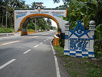
     From top, left to right: Quezon-Laguna Boundary Arch, Saint John the Baptist Parish Church, Municipal Hall, Claro M. Recto Memorial Shrine, Villa Escudero | |
 Flag  Seal | |
Nicknames:
| |
 Map of Quezon with Tiaong highlighted | |
OpenStreetMap  | |
.svg) Tiaong Location within the Philippines | |
| Coordinates: 13°57′N 121°19′E / 13.95°N 121.32°E | |
| Country | Philippines |
| Region | Calabarzon |
| Province | Quezon |
| District | 2nd district |
| Founded | May 12, 1691 |
| Barangays | 31 (see Barangays) |
| Government | |
| • Type | Sangguniang Bayan |
| • Mayor | Vincent Arjay M. Mea |
| • Vice Mayor | Roderick A. Umali |
| • Representative | David C. Suarez |
| • Municipal Council | Members |
| • Electorate | 64,797 voters (2022) |
| Area | |
| • Total | 168.38 km2 (65.01 sq mi) |
| Elevation | 94 m (308 ft) |
| Highest elevation | 849 m (2,785 ft) |
| Lowest elevation | 11 m (36 ft) |
| Population (2020 census)[3] | |
| • Total | 106,265 |
| • Density | 630/km2 (1,600/sq mi) |
| • Households | 26,509 |
| Demonym | Tiaongin |
| Economy | |
| • Income class | 1st municipal income class |
| • Poverty incidence | 6.78 |
| • Revenue | ₱ 312.2 million (2020) |
| • Assets | ₱ 1,265 million (2020) |
| • Expenditure | ₱ 221.9 million (2020) |
| • Liabilities | ₱ 495.4 million (2020) |
| Service provider | |
| • Electricity | Manila Electric Company (Meralco) |
| Time zone | UTC+8 (PST) |
| ZIP code | 4325 |
| PSGC | |
| IDD : area code | +63 (0)42 |
| Native languages | Tagalog |
| Website | tiaongquezon |
Tiaong ([ˈtjaɔŋ]), officially the Municipality of Tiaong (Tagalog: Bayan ng Tiaong), is a first-class municipality in the province of Quezon, Philippines. According to the 2020 census, it has a population of 106,265 people.[3]
Tiaong is 35 kilometers (22 mi) from Lucena and 95 kilometers (59 mi) from Manila.
Etymology[edit]
According to local legends, Tiaong derived its name from the portmanteau of two words:
- Tiya (tia), Tagalog for aunt in reference to Doña Tating, a well-loved woman in the area; and
- Ong (oong) from the sound of her bull that signalled her nearby presence.[5]
History[edit]
In 1957, the following barrios were created:
Geography[edit]
Barangays[edit]
Tiaong is politically subdivided into 31 barangays. Each barangay consists of puroks and some have sitios.
- Anastacia
- Aquino
- Ayusan I
- Ayusan II
- Behia
- Bukal
- Bula
- Bulakin
- Cabatang
- Cabay
- Del Rosario
- Lagalag
- Lalig
- Lumingon
- Lusacan
- Paiisa
- Palagaran
- Poblacion I
- Poblacion II
- Poblacion III
- Poblacion IV
- Quipot
- San Agustin
- San Isidro
- San Jose
- San Juan
- San Pedro
- Tagbakin
- Talisay
- Tamisian
- San Francisco
Climate[edit]
| Climate data for Tiaong, Quezon | |||||||||||||
|---|---|---|---|---|---|---|---|---|---|---|---|---|---|
| Month | Jan | Feb | Mar | Apr | May | Jun | Jul | Aug | Sep | Oct | Nov | Dec | Year |
| Mean daily maximum °C (°F) | 27 (81) |
28 (82) |
30 (86) |
32 (90) |
31 (88) |
30 (86) |
29 (84) |
29 (84) |
29 (84) |
29 (84) |
28 (82) |
27 (81) |
29 (84) |
| Mean daily minimum °C (°F) | 20 (68) |
20 (68) |
21 (70) |
22 (72) |
24 (75) |
24 (75) |
24 (75) |
24 (75) |
24 (75) |
23 (73) |
22 (72) |
21 (70) |
22 (72) |
| Average precipitation mm (inches) | 52 (2.0) |
35 (1.4) |
27 (1.1) |
27 (1.1) |
82 (3.2) |
124 (4.9) |
163 (6.4) |
144 (5.7) |
145 (5.7) |
141 (5.6) |
100 (3.9) |
102 (4.0) |
1,142 (45) |
| Average rainy days | 12.0 | 8.1 | 8.8 | 9.7 | 17.9 | 22.6 | 26.2 | 24.5 | 24.6 | 22.0 | 16.7 | 14.9 | 208 |
| Source: Meteoblue[9] | |||||||||||||
Demographics[edit]
| Year | Pop. | ±% p.a. |
|---|---|---|
| 1903 | 9,527 | — |
| 1918 | 14,211 | +2.70% |
| 1939 | 27,179 | +3.14% |
| 1948 | 26,454 | −0.30% |
| 1960 | 26,084 | −0.12% |
| 1970 | 38,725 | +4.03% |
| 1975 | 43,245 | +2.24% |
| 1980 | 48,606 | +2.36% |
| 1990 | 60,662 | +2.24% |
| 1995 | 67,403 | +1.99% |
| 2000 | 75,498 | +2.46% |
| 2007 | 87,707 | +2.09% |
| 2010 | 91,599 | +1.59% |
| 2015 | 99,712 | +1.63% |
| 2020 | 106,265 | +1.26% |
| Source: Philippine Statistics Authority[10][11][12][13] | ||
Economy[edit]
Poverty Incidence of Tiaong
Graphs are unavailable due to technical issues. There is more info on Phabricator and on MediaWiki.org. |
Government[edit]

Elected officials[edit]
| Position | Name of official |
|---|---|
| District Representative (2nd Legislative District, Quezon) | Rep. David C. Suarez |
| Municipal Mayor | Vincent Arjay M. Mea |
| Municipal Vice Mayor | Roderick A. Umali |
| Municipal Councilors | Ma. Maja Alexandra E. Landicho |
| Romano P. Castillo Jr. | |
| Eugene P. Lopez | |
| Elton Rex B. Baldeo | |
| Rex D. Bautista | |
| Jessa L. Preza | |
| Jonas Bryson R. Atienza | |
| Tomas P. Ilao |
Tourism[edit]
- Moises Amat Escueta Ala-ala Park
- Saint John the Baptist Parish Church of Tiaong
- Escudero, Villa escudero
Education[edit]


Elementary schools[edit]
- Private school
- Southside Integrated School
- Kiddie Corner School Inc.
- Saint John Parochial School
- Gaudete Study Center Inc.
- Tiaong Christian Academy
- Maranatha Christian Academy
- Geriane Rainbow School
- Public School
- Anastacia Elementary School
- Lusacan Elementary School
- Del Rosario Elementary School
- Lagalag Elementary School
- Hilirang Buli Elementary School
- Tiaong East Elementary School
- Claro M. Recto Memorial Central School
High schools[edit]
- Private School
- St. John Parochial School
- Don Ysidro Memorial School
- Gaudete Study Center Inc.
- Public High School
- Recto Memorial National High School
- Lalig National High School
- Lusacan National High School
- Cabay National High School
- Gloria Umali National High School
- Paiisa National High School
- Talisay National High School
Colleges and universities[edit]
- Public Schools
- College
- Southern Luzon State University
- Private Schools:
- Asian Institute of Technology and Education
- Olinsterg College
Gallery[edit]
-
-
 Saint John the Baptist Parish Church of Tiaong
 -
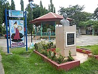 Moises Amat Escueta Ala-ala Park
 -
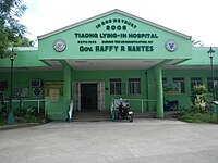 Tiaong Lying-In Hospital
 -
 Type 89 I-Go tank at Villa Escudero, Tiaong, Quezon Province


References[edit]
- ^ Municipality of Tiaong | (DILG)
- ^ "2015 Census of Population, Report No. 3 – Population, Land Area, and Population Density" (PDF). Philippine Statistics Authority. Quezon City, Philippines. August 2016. ISSN 0117-1453. Archived (PDF) from the original on May 25, 2021. Retrieved July 16, 2021.
- ^ a b Census of Population (2020). "Region IV-A (Calabarzon)". Total Population by Province, City, Municipality and Barangay. Philippine Statistics Authority. Retrieved 8 July 2021.
- ^ "PSA Releases the 2018 Municipal and City Level Poverty Estimates". Philippine Statistics Authority. 15 December 2021. Retrieved 22 January 2022.
- ^ Tayao, Annelle S. (March 10, 2012). "Tiaong has its come-ons". INQUIRER.net. Retrieved August 15, 2023.
- ^ Republic Act No. 1765 (21 June 1957), An Act Creating the Barrio of Matipunso in the Municipality of Tiaong, Province of Quezon, retrieved August 15, 2023
- ^ Republic Act No. 1766 (21 June 1957), An Act Creating the Barrio of Behia in the Municipality of Tiaong, Province of Quezon
- ^ Republic Act No. 1767 (21 June 1957), An Act Creating the Barrio of Bucal in the Municipality of Tiaong, Province of Quezon, retrieved August 15, 2023
- ^ "Tiaong: Average Temperatures and Rainfall". Meteoblue. Retrieved 27 January 2020.
- ^ Census of Population (2015). "Region IV-A (Calabarzon)". Total Population by Province, City, Municipality and Barangay. Philippine Statistics Authority. Retrieved 20 June 2016.
- ^ Census of Population and Housing (2010). "Region IV-A (Calabarzon)" (PDF). Total Population by Province, City, Municipality and Barangay. National Statistics Office. Retrieved 29 June 2016.
- ^ Censuses of Population (1903–2007). "Region IV-A (Calabarzon)". Table 1. Population Enumerated in Various Censuses by Province/Highly Urbanized City: 1903 to 2007. National Statistics Office.
{{cite encyclopedia}}: CS1 maint: numeric names: authors list (link) - ^ "Province of Quezon". Municipality Population Data. Local Water Utilities Administration Research Division. Retrieved 17 December 2016.
- ^ "Poverty incidence (PI):". Philippine Statistics Authority. Retrieved December 28, 2020.
- ^ "Estimation of Local Poverty in the Philippines" (PDF). Philippine Statistics Authority. 29 November 2005.
- ^ "2003 City and Municipal Level Poverty Estimates" (PDF). Philippine Statistics Authority. 23 March 2009.
- ^ "City and Municipal Level Poverty Estimates; 2006 and 2009" (PDF). Philippine Statistics Authority. 3 August 2012.
- ^ "2012 Municipal and City Level Poverty Estimates" (PDF). Philippine Statistics Authority. 31 May 2016.
- ^ "Municipal and City Level Small Area Poverty Estimates; 2009, 2012 and 2015". Philippine Statistics Authority. 10 July 2019.
- ^ "PSA Releases the 2018 Municipal and City Level Poverty Estimates". Philippine Statistics Authority. 15 December 2021. Retrieved 22 January 2022.
External links[edit]
Wikimedia Commons has media related to Tiaong.
- Tiaong Profile at PhilAtlas.com
- Philippine Standard Geographic Code
- Philippine Census Information
- Local Governance Performance Management System
Places adjacent to Tiaong | |
|---|---|
Lucena (capital and largest city) | |
| Municipalities |
|
| Component city | |
| Highly urbanized city |
|
| Authority control databases: Geographic |
|---|