
Aylesbury: Difference between revisions
Roleplayer (talk | contribs) Undid revision 199122598 by 82.0.164.20 (talk) no corresponding article |
→Transport: Added references and added cite news template to others |
||
| Line 108: | Line 108: | ||
==Transport== |
==Transport== |
||
===Road=== |
|||
| ⚫ | The railway came to Aylesbury in 1839 when the [[Cheddington to Aylesbury Line|Aylesbury Railway]] opened from [[Cheddington]] on [[Robert Stephenson]]'s [[London and Birmingham Railway]]. The Wycombe Railway (later [[GWR]] |
||
Aylesbury is served by the [[A41 road|A41]], which runs from [[London]] to [[Birkenhead]]. The [[A413 road|A413]] and [[A418 road|A418]] roads also run through the town. The [[M40 motorway]] at junction 9 is 14.7 miles away and the [[M25 motorway]] is just over 21 miles drive. |
|||
| ⚫ | In 2006, work commenced on the Public Transport Hub, a scheme comprising of a one-way loop of bus lanes around the town's inner ring road, which includes improvements to the connectivity between bus and rail services. Stage One of this scheme was completed in December 2006, with Stage Two commencing in early 2007.<ref>{{cite news | url=http://www.buckscc.gov.uk/bcc/content/index.jsp?contentid=1129955964| title=Transport Hub | publisher=Bucks County Council| date=| accessdate=2008-04-05}}</ref> |
||
| ⚫ | A rail scheme is proposed<ref> |
||
===Rail=== |
|||
| ⚫ | A further expansion of rail services to Bletchley and Bedford is suggested in a consultants' report<ref> |
||
| ⚫ | The railway came to Aylesbury in 1839 when the [[Cheddington to Aylesbury Line|Aylesbury Railway]] opened from [[Cheddington]] on [[Robert Stephenson]]'s [[London and Birmingham Railway]]. The Wycombe Railway (later [[GWR]]) arrived via [[Princes Risborough]] on [[1st October]] 1863, and on [[23rd September]] 1868 the Aylesbury and Buckingham Railway (later Metropolitan Railway) was opened from [[Verney Junction]], to make an end-on junction with the Wycombe Railway. The [[Metropolitan Railway]] (MetR) from [[Baker Street tube station|Baker Street]] arrived via [[Amersham]] in 1892.<ref>{{cite news | url=http://www.20thcenturylondon.org.uk/server.php?show=ConInformationRecord.346| title=Metropolitan Railway | publisher=20th Century London| date=| accessdate=2008-04-05}}</ref> The [[Great Central Railway]] (GCR) connected from [[Nottingham Victoria]] to [[London Marylebone]] via the MetR in 1899. Between 1899 and 1953, Aylesbury had railway links to four [[London]] termini: Marylebone, Baker Street, [[London Paddington|Paddington]], [[London Euston|Euston]]. The Aylesbury Railway closed in 1953, The MetR, which later became the [[Metropolitan Line]] of the [[London Underground]] withdrew north of Aylesbury in 1936 <ref>{{cite news | url=http://underground-history.co.uk/amersham.php| title=Quainton Road to Verney Junction| publisher=Underground History| date=| accessdate=2008-04-05}}</ref> and withdrew from the town in 1961.<ref>{{cite news | url=http://www.davros.org/rail/culg/metropolitan.html| title=Metropolitan Line | publisher=Davros| date=| accessdate=2008-04-05}}</ref> The GCR was dismantled north of Aylesbury in 1966. As a result, there are now no regular passenger services north of Aylesbury. Now only the GCR south of Aylesbury to Marylebone is used for regular London services. |
||
| ⚫ | A rail scheme is proposed to extend passenger services northwestwards to a new station, [[Aylesbury Vale Parkway railway station|Aylesbury Vale Parkway]].<ref>{{cite news | url=http://www.buckscc.gov.uk/transport_plan/LTP2/thirty_yr_vision.htm| title=Bucks County Council Thirty Year Transport Vision| publisher=Bucks County Council| date=| accessdate=2008-04-05}}</ref> This will be sited on the present freight-only line towards Quainton at the point where the line crosses the A41 near Berryfields Farm, some 2.25 miles north of the current Aylesbury station. This area is to be known as the Berryfields Major Development Area, and will include Park and Ride facilities for Aylesbury. |
||
| ⚫ | In 2006, work commenced on the Public Transport Hub, a scheme comprising of a one-way loop of bus lanes around the town's inner ring road, which includes improvements to the connectivity between bus and rail services. Stage One of this scheme was completed in December 2006, with Stage Two |
||
| ⚫ | A further expansion of rail services to Bletchley and Bedford is suggested in a consultants' report <ref>{{cite news | url=http://www.southeast-ra.gov.uk/southeastplan/key/study_areas/draft_strategies/mkav/aylesbury_vale-draft_strategy.pdf | title=Aylesbury Vale Draft transport Strategy | publisher=Bucks County Council| date=| accessdate=2008-04-05}}</ref> written to provide regional planning guidance to Bucks County Council concerning the development of Aylesbury Vale. Also the Great Central may be rebuilt in the future towards [[Rugby, Warwickshire|Rugby]] as the railway is in need for expansion to ease capacity constraints. |
||
| ⚫ | |||
| ⚫ | In 2005 the town won £1million funding to be one of six [[Cycling Demonstration town]]s in [[England]], which was match-funded by [[Buckinghamshire County Council]]. This allows Buckinghamshire County Council to promote the use of cycling amongst the general public, as well as provide facilities for cyclists, such as bike lockers, bike stands as well as [[Tiger crossing|Tiger]] and [[Toucan crossing|Toucan]] road crossings. |
||
| ⚫ | |||
| ⚫ | Cycle Aylesbury, the team created to undertake the Cycling Demonstration town work, recently opened the first of their Gemstone Cycleways, which are a network of routes running from Aylesbury Town Centre to various locations around the town, including Stone, [[Bierton]], [[Wendover]] and Watermead. A second brochure/magazine was put out to accompany the routes, along with a redesigned website |
||
| ⚫ | In 2005 the town won £1million funding to be one of six [[Cycling Demonstration town]]s in [[England]], which was match-funded by [[Buckinghamshire County Council]].<ref>{{cite news | url=http://www.cyclingengland.co.uk/dt_aylesbury.php| title=Aylesbury | publisher=Cycling England| date=| accessdate=2008-04-05}}</ref> This allows Buckinghamshire County Council to promote the use of cycling amongst the general public, as well as provide facilities for cyclists, such as bike lockers, bike stands as well as [[Tiger crossing|Tiger]] and [[Toucan crossing|Toucan]] road crossings. |
||
| ⚫ | Cycle Aylesbury, the team created to undertake the Cycling Demonstration town work, recently opened the first of their Gemstone Cycleways, which are a network of routes running from Aylesbury Town Centre to various locations around the town, including Stone, [[Bierton]], [[Wendover]] and Watermead. A second brochure/magazine was put out to accompany the routes, along with a redesigned website, [http://www.cycleaylesbury.co.uk CycleAylesbury.co.uk]. |
||
The aim of the project is to effect a threefold rise in cyclist levels around the town by 2008. Cycle Aylesbury are well on the way to achieving that figure, focusing on commuters and working in partnership with local organisations to effect a cultural shift. |
|||
== Notable residents == |
== Notable residents == |
||
Revision as of 16:57, 5 April 2008
| Aylesbury | |
|---|---|
| Population | 69,173 |
| OS grid reference | SP818138 |
| • London | 41.6m |
| District | |
| Shire county | |
| Region | |
| Country | England |
| Sovereign state | United Kingdom |
| Post town | AYLESBURY |
| Postcode district | HP19, HP20, HP21 |
| Dialling code | 01296 |
| Police | Thames Valley |
| Fire | Buckinghamshire |
| Ambulance | South Central |
| UK Parliament | |
Aylesbury is the county town of Buckinghamshire in south east England. It had a population in the 2001 census of 65,173 and is part of the London commuter belt.
History
The town name is Anglo-Saxon, though excavations in the town centre in 1985 found an Iron Age hillfort dating from around 650BC. The town is sited on an outcrop of Portlandian limestone which accounts for its prominent position in the surrounding landscape, which is largely clay. Aylesbury was a major market town in Anglo-Saxon times, famous in addition as the burial place of Saint Osyth, whose shrine attracted pilgrims. The Early English parish church of St. Mary (with many later additions) may be built over the remains of a Saxon crypt. At the Conquest, the king took the manor of Aylesbury for himself, and it is listed as a royal manor in the Domesday Book, 1086.
In 1450 a religious institution called the Guild of St Mary was founded in Aylesbury by John Kemp, Archbishop of York. Known popularly as the Guild of Our Lady it became a meeting place for local dignitaries and a hotbed of political intrigue. The Guild was influential in the final outcome of the Wars of the Roses. Its premises at the Chantry in Church Street, Aylesbury, are still there, though today the site is occupied mainly by almshouses.
Aylesbury was declared the county town of Buckinghamshire in 1529 by King Henry VIII: Aylesbury Manor was among the many properties belonging to Thomas Boleyn the father of Anne Boleyn and it is rumoured that the change was made by the king in order to curry favour with the holders of the manor. (Previously the county town of Buckinghamshire was Buckingham).

The town played a large part in the English Civil War when it became a stronghold for the Parliamentarian forces, like many market towns a nursing-ground of Puritan sentiment. Its proximity to Great Hampden, home of John Hampden has made of Hampden a local hero: his silhouette is on the emblem used by Aylesbury Vale District Council and his statue stands prominently in the town centre. Aylesbury born composer, Rutland Boughton (1878-1960), possibly inspired by the statue of John Hampden, created a symphony based on Oliver Cromwell. The town's heraldic crest is the Aylesbury duck, which has been bred here since the birth of the Industrial Revolution. The Jacobean mansion of Hartwell nearby was the residence of Louis XVIII during his exile (1810 – 1814). The town also received international publicity in the 1960s when the culprits responsible for the Great Train Robbery were tried at Aylesbury Crown Court. The robbery took place at Bridego Bridge, a railway bridge at Ledburn, about six miles from the town. The 7 July 2005 Piccadilly Line bomber Germaine Lindsay's home was in Aylesbury at the time of the bombings, though he was originally from Jamaica.
A notable institution is Aylesbury Grammar School, which was founded in 1598; other notable buildings are the King's Head Inn, which with the Fleece Inn at Bretforton is one of the few public houses in the country owned by the National Trust still run as a public house, and the Queens Park Centre, the UK's largest independent arts centre.
Chequers, the country residence of the Prime Minister of the United Kingdom since 1921, is just south-east of Aylesbury.
James Henry Govier the British painter and etcher resided at Aylesbury and produced a number of works relating to the town including the church, canal, Walton, Aylesbury Gaol, The King's Head and views of the town during the 1940s and 1950s, examples of which can be seen in the county museum in Aylesbury. Govier was born at Oakley, and was the etching demonstrator at The Royal College of Art.
Modern Aylesbury
The town's population has doubled since the 1960s due to new housing developments, including many London overspill housing estates, built to ease pressure on the capital, and to move people from crowded inner city slums to more favourable locations. Indeed Aylesbury, to a greater extent than many English market towns, saw substantial areas of its own heart demolished in the 1950s/1960s as 16th-18th century houses (many in good repair) were pulled down to make way for commercial developments.
Aylesbury's population was expected to increase between 2003 and 2005 with a new housing estate designed to cater for eight thousand people on the north side of the town, sandwiched between the A41 (Akeman Street) and the A413, and the expansion of Fairford Leys village.
Housing estates in the modern Aylesbury include: Bedgrove, Broughton, Elm Farm, Elmhurst, Fairford Leys, Haydon Hill, Hawkslade Farm, Meadowcroft, Prebendal Farm, Quarrendon, Queens Park, Southcourt, Stoke Grange, Walton Court, Watermead and The Willows. Aylesbury has also been extended to completely surround the former hamlets or farms at Bedgrove, California, New Zealand, Prebendal Farm, Quarrendon, Turnfurlong and Walton. If plans to increase the size of the town by twenty thousand people go ahead, suburban Aylesbury could well meet up with the neighbouring villages of Bierton, Hartwell, Stoke Mandeville, Stone, Sedrup and Weston Turville. Areas most popular in the town are the Conservation Area around St. Mary's church and Queens Park, particularly facing onto the canal.
The town centre has many pubs and bars, along with some nightclubs, and Friday and Saturday nights can be lively. The Saracen's Head public house in the conservation area at the centre of Aylesbury is popular with the lesbian and gay community.
The local newspaper is The Bucks Herald. The local radio station is Mix 96.
One of the more prominent buildings in Aylesbury is the "Blue Leanie" office block, home to Halifax Bank of Scotland (HBOS). When first built it was thought to be a potential hazard to passing motorists, due to the sun reflecting off its large mirrored surface. As a result a line of trees was planted alongside the main road to prevent dazzling.[1]
The town is served by Aylesbury railway station, which is the present terminus of passenger services from London Marylebone.
In recent years Aylesbury has had a lot of bad press, with several murders and being home to Germaine Lindsay, one of the suicide bombers behind the 7 July 2005 London bombings.
There are several developments that are due to take place in the coming years. A new £27 million, 1,200 seat theatre, designed by the renowned RHWL Architects is currently under construction and will be complete in late 2009. In addition to this, the surrounding area is being redeveloped as part of the £100 million Waterside project. When this is completed, currently planned to be late 2010, there will be 260,000 sq ft of new retail floor space, 1,100 new jobs and an urban environment.
Architecture


The architecture of Aylesbury reflects the ordinary architecture which can be found in many small towns in England. John Vanbrugh judged two sets of plans for the County Hall (now Aylesbury Crown Court); however, the buildings of the town were designed by local architects.
Aylesbury retains some buildings from the medieval, Georgian and Victorian periods, as well as the 20th century. Ceely House (part of the County Museum), Ardenham House, the Union Workhouse and The County Gaol are among the most notable buildings in the town.
St Mary's church, sited upon a hill surrounded by narrow streets and squares of substantial 18th century town houses, such as Castle Street, Temple Square and Parson's Fee give an indication of how Aylesbury may have appeared in the 18th century.
Education
Aylesbury is home to one College of General Further Education (Aylesbury College on Oxford Road), three grammar schools and three community upper schools and a host of primary schools. The secondary schools are:
- Aylesbury Grammar School (boys only)
- Aylesbury High School (girls only)
- The Grange School
- Mandeville Upper School
- Quarrendon School
- Sir Henry Floyd Grammar School
There are also the following special schools, that teach secondary school age children with learning disabilities:
- Pebble Brook School
- Stocklake Park Community School, formerly Park School
The Aylesbury Vale Secondary Support Centre[2] is a Pupil Referral Unit (PRU), which caters for permanently excluded students.
Administration
Aylesbury Town Council is the parish council for the town. In 2006, it comprises 23 councillors all of which are members of the Liberal Democrats political party. The council represents only the constituents of Aylesbury town itself. Surrounding villages and some recent developments on the outskirts of Aylesbury like Fairford Leys & Watermead have their own parish council.
The Town Council is in a process of discussions to take over responsibility for some public services from Aylesbury Vale District Council.
Trade and industry
Traditionally the town was a commercial centre with a market dating back to the Saxon period. This is because it was established on the main Akeman Street which became an established trade route linking London to the southwest. In 1180 a gaol was established in the town (it is still there though has moved locations two or three times) which only really happened in main towns across the country.
By 1477 flour was being ground in the town for surrounding parishes. By the modern period this had grown into a huge established industry: the last mill in Aylesbury was closed in the 1970s. By 1560 the manufacture of needles had become a large industry in Long Crendon, a village close to Aylesbury, which was an important production centre.
In 1672 poor children in Buckinghamshire were taught to make lace as a way to make a living. Bucks lace as it became known quickly became very sought after and production boomed as the lace was mainly made by poor women and children. The lace-making industry had died out by Victorian times, however, as new machine-made lace became preferable.
In 1764 Euclid Neale opened his clock making workshop in Aylesbury. In the 18th century he was one of the best clock makers in the country.
In 1814 the Aylesbury arm of the Grand Union Canal from Marsworth was opened bringing major industry to the town for the first time. At the same time the Wendover arm was built leading to nearby Wendover.
By the late 19th century the printers and bookbinders Hazell, Watson and Viney and the Nestlé dairy were the two main employers in the town, employing more than half the total population.
Today the town is still a major commercial centre and the market still meets on the cobbles of the old Market Square four days a week. Nestle and Hazell, Watson and Viney have both gone, though three major industrial centres make sure the town has one of the lowest unemployment rates in the country.
Transport
Road
Aylesbury is served by the A41, which runs from London to Birkenhead. The A413 and A418 roads also run through the town. The M40 motorway at junction 9 is 14.7 miles away and the M25 motorway is just over 21 miles drive.
In 2006, work commenced on the Public Transport Hub, a scheme comprising of a one-way loop of bus lanes around the town's inner ring road, which includes improvements to the connectivity between bus and rail services. Stage One of this scheme was completed in December 2006, with Stage Two commencing in early 2007.[3]
Rail
The railway came to Aylesbury in 1839 when the Aylesbury Railway opened from Cheddington on Robert Stephenson's London and Birmingham Railway. The Wycombe Railway (later GWR) arrived via Princes Risborough on 1st October 1863, and on 23rd September 1868 the Aylesbury and Buckingham Railway (later Metropolitan Railway) was opened from Verney Junction, to make an end-on junction with the Wycombe Railway. The Metropolitan Railway (MetR) from Baker Street arrived via Amersham in 1892.[4] The Great Central Railway (GCR) connected from Nottingham Victoria to London Marylebone via the MetR in 1899. Between 1899 and 1953, Aylesbury had railway links to four London termini: Marylebone, Baker Street, Paddington, Euston. The Aylesbury Railway closed in 1953, The MetR, which later became the Metropolitan Line of the London Underground withdrew north of Aylesbury in 1936 [5] and withdrew from the town in 1961.[6] The GCR was dismantled north of Aylesbury in 1966. As a result, there are now no regular passenger services north of Aylesbury. Now only the GCR south of Aylesbury to Marylebone is used for regular London services.
A rail scheme is proposed to extend passenger services northwestwards to a new station, Aylesbury Vale Parkway.[7] This will be sited on the present freight-only line towards Quainton at the point where the line crosses the A41 near Berryfields Farm, some 2.25 miles north of the current Aylesbury station. This area is to be known as the Berryfields Major Development Area, and will include Park and Ride facilities for Aylesbury.
A further expansion of rail services to Bletchley and Bedford is suggested in a consultants' report [8] written to provide regional planning guidance to Bucks County Council concerning the development of Aylesbury Vale. Also the Great Central may be rebuilt in the future towards Rugby as the railway is in need for expansion to ease capacity constraints.
Cycling Demonstration town
In 2005 the town won £1million funding to be one of six Cycling Demonstration towns in England, which was match-funded by Buckinghamshire County Council.[9] This allows Buckinghamshire County Council to promote the use of cycling amongst the general public, as well as provide facilities for cyclists, such as bike lockers, bike stands as well as Tiger and Toucan road crossings.
Cycle Aylesbury, the team created to undertake the Cycling Demonstration town work, recently opened the first of their Gemstone Cycleways, which are a network of routes running from Aylesbury Town Centre to various locations around the town, including Stone, Bierton, Wendover and Watermead. A second brochure/magazine was put out to accompany the routes, along with a redesigned website, CycleAylesbury.co.uk.
Notable residents
Aylesbury is or has been home to a whole range of notable people. In the latter part of the 20th century the main maternity unit in the district was located in Aylesbury at the Royal Buckinghamshire Hospital; hence a large number of people were born in Aylesbury who may not have had any other association with the town. For a full list see People from Aylesbury. In alphabetic order of surname those who live or have lived in Aylesbury include:
- Benjamin Bates, physician
- Lynda Bellingham, actress and television presenter
- Francis Bernard, British colonial governor, died in Aylesbury
- Ernest Bullock, organist and composer, died in Aylesbury
- Brendan Carr, actor, was born in Aylesbury
- Mathilde Carré, French double agent, was once a detainee at Aylesbury Prison
- Martin Grech, singer-songwriter
- Swami Laura Horos, medium, was once a detainee at Aylesbury Prison
- John Junkin, television performer and scriptwriter, died in Aylesbury
- Germaine Lindsay, terrorist, was living in Aylesbury when he died
- Alfred E. Moss, racing car driver, died in Aylesbury
- John Otway, singer-songwriter
- Charles William Pearson, missionary
- James Clark Ross, naval explorer, died in Aylesbury
- Vernon Scannell, poet
- William of Sherwood, logician and teacher
- Mike Smith of The Dave Clark Five lived in Aylesbury
- Vincent Strudwick, theologian
- Pete Trewavas, guitarist with the band Marillion, grew up in Aylesbury
- Mark Webber, Australian Formula 1 driver, has a house in Aylesbury
Popular culture
Aylesbury has several notable entries in modern popular culture.

There used to be a club in Aylesbury in the 1970s and 1980s called the Friars Club where a lot of the top bands of the time played, including The Clash, Genesis, U2, David Bowie, Marillion and The Ramones. The band Marillion originally formed here, with the band's first single, 1982's Market Square Heroes taking its title inspiration from Aylesbury Market Square.
Aylesbury is mentioned in Blackadder's Christmas Carol:
- Edmund: No, of course not, Ma'am... and perhaps Lord Melchett would like to whip me naked through the streets of Aberdeen...
- Melchett: Oh, I don't think we need go that far, Blackadder...
- Edmund: Oh, too kind...
- Melchett: No, Aylesbury's quite far enough.
Also it is widely believed that the scene in the opening of the film A Clockwork Orange when the droogs beat up the elderly Irish man was filmed in Aylesbury, in the underpass linking Friars Square Shopping Centre with the railway station. Even Christiane Kubrick's book Stanley Kubrick - A Life In Pictures states this, however the scene was actually filmed in South London. Another scene from the film was shot in Friars Square itself but never made it to the final cut. This is the 'Librarian Scene' where outtakes from the shoot and rehearsal can be seen in Alison Castle's The Stanley Kubrick Archives published by Taschen.
According to Malcolm McDowell on Camera 2 in the summer of 2002: "We did a sequence in Aylesbury. The town square was decorated with giant rubber ducks, weird animals, they were huge, and we accosted an old guy from the library. I ripped out these priceless books that he had and I threw them up. I remember my line, it was taken from the book, it was: 'There's a mackerel of a cornflake for you.' The pages from the ripped books fall like confetti. The retribution was that Alex goes to the library when he is cured and all the old codgers in the library go: 'You were the one!'"
Finally the County Court building and Aylesbury Market Square regularly feature in the BBC Television series Judge John Deed.
Geography
Aylesbury is located at 51°50′00″N 00°50′00″W / 51.83333°N 0.83333°W (51.8333, -0.8333)1.
Twin towns
Aylesbury is twinned with:
Places of interest
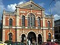
Gallery
-
Kingsbury, Aylesbury
-
Market Square, Aylesbury
-
 Aylesbury Methodist Church in Buckingham Street
 -
County Hall taken from the Grand Union Canal
-
 Parish church of St Mary, Aylesbury
 -
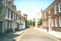 Church Street, Aylesbury
 -
Church Street, Aylesbury
-
 Bucks New County Offices
 -
 Blue Leanie office block, home to Halifax Bank of Scotland (HBOS).


References
- ^ Geograph.org.uk
- ^ Aylesbury Vale Secondary Support Centre
- ^ "Transport Hub". Bucks County Council. Retrieved 2008-04-05.
- ^ "Metropolitan Railway". 20th Century London. Retrieved 2008-04-05.
- ^ "Quainton Road to Verney Junction". Underground History. Retrieved 2008-04-05.
- ^ "Metropolitan Line". Davros. Retrieved 2008-04-05.
- ^ "Bucks County Council Thirty Year Transport Vision". Bucks County Council. Retrieved 2008-04-05.
- ^ "Aylesbury Vale Draft transport Strategy" (PDF). Bucks County Council. Retrieved 2008-04-05.
- ^ "Aylesbury". Cycling England. Retrieved 2008-04-05.