
Template:Syrian Civil War detailed map: Difference between revisions
Content deleted Content added
Zimrin, per pro-opp map: https://twitter.com/CdricLabrousse/status/461583617706045441/photo/1 |
Inkhil per agreement from sources from both pro regime http://www.syrianperspective.com/2014/04/syrian-army-grinds-bones-in-derah-as-rats-trapped-in-jaassem-inkhil.html and pro opp https://twitter.com/CdricLabrousse/status/461583617706045441/photo/1 |
||
| Line 371: | Line 371: | ||
{{#invoke:location map|mark |Syria |lat=33.063|long=35.995 |mark=Abm-red-icon.png |marksize=7|link=Tell Al-Harra |label=[[Tell Al-Harra]] |label_size=0 |position=right}} |
{{#invoke:location map|mark |Syria |lat=33.063|long=35.995 |mark=Abm-red-icon.png |marksize=7|link=Tell Al-Harra |label=[[Tell Al-Harra]] |label_size=0 |position=right}} |
||
{{#invoke:location map|mark |Syria |lat=32.751|long=36.305 |mark=Location dot lime.svg |marksize=11|link=Cities and towns during the Syrian civil war#Al-Hirak, Syria |label=[[Cities and towns during the Syrian civil war#Al-Hirak|Hirak]] |label_size=100 |position=left}} |
{{#invoke:location map|mark |Syria |lat=32.751|long=36.305 |mark=Location dot lime.svg |marksize=11|link=Cities and towns during the Syrian civil war#Al-Hirak, Syria |label=[[Cities and towns during the Syrian civil war#Al-Hirak|Hirak]] |label_size=100 |position=left}} |
||
{{#invoke:location map|mark |Syria |lat=33.017|long=36.128 |mark= |
{{#invoke:location map|mark |Syria |lat=33.017|long=36.128 |mark=Location dot lime.svg |marksize=10|link=Cities and towns during the Syrian civil war#Inkhil |label=[[Cities and towns during the Syrian civil war#Inkhil| Inkhil]] |label_size=100 |position=right}} |
||
{{#invoke:location map|mark |Syria |lat=32.870|long=36.254 |mark=Location dot red.svg |marksize=8 |
{{#invoke:location map|mark |Syria |lat=32.870|long=36.254 |mark=Location dot red.svg |marksize=8 |
||
|link=Cities and towns during the Syrian civil war#Izra|label=[[Cities and towns during the Syrian civil war#Izra|Izra]] |label_size=90 |position=top}} |
|link=Cities and towns during the Syrian civil war#Izra|label=[[Cities and towns during the Syrian civil war#Izra|Izra]] |label_size=90 |position=top}} |
||
Revision as of 00:15, 1 May 2014


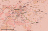


Hold cursor over location to display name; click to go to location row in the "table of cities and towns" (if available).
 Government-held ;
  Opposition-held (except ISIL) ;
  ISIL-held ;
  Kurd-held
Contested : Gov't-main rebels ;
  gov't-kurds ;
  gov't-ISIS ;
  main rebels-kurds ;
  main rebels-ISIS ;
  kurds-ISIS ;
  3-way ;
 Military base ;
  Airport/Air base (jet) ;
  Airport/Air base (helicopter)
  Major port or naval base;
  Border Post ;
  Dam
Dam
2 nested circles: inner controls, outer sieges // 3 nested circles: mixed control with stable situation // Small icons within large circle: situation in individual neighbourhoods/districts
Contested :
2 nested circles: inner controls, outer sieges // 3 nested circles: mixed control with stable situation // Small icons within large circle: situation in individual neighbourhoods/districts
| This template may have no transclusions, because it is substituted by a tool or script, it is used as part of a short-term or less active Wikipedia process, or for some other reason. |
| This template uses Lua: |
How war map template work with other parts of Wikipedia
