
Template:Syrian Civil War detailed map: Difference between revisions
Content deleted Content added
Again, removed towns added without proper source |
Hanibal911 (talk | contribs) need confirmation from the fresh and reliable source that the city Afrah under rebel control because data from SOHR outdated and also we cant use the map from the pro opposition source to display the rebel advances |
||
| Line 292: | Line 292: | ||
{{#invoke:location map|mark |Syria |lat=33.674|long=36.123 |mark=Location dot red.svg |marksize=6 |label=[[Hurayra]]|link=Hurayra |label_size=0|position=right}} |
{{#invoke:location map|mark |Syria |lat=33.674|long=36.123 |mark=Location dot red.svg |marksize=6 |label=[[Hurayra]]|link=Hurayra |label_size=0|position=right}} |
||
{{#invoke:location map|mark |Syria |lat=33.625|long=36.108 |mark=Location dot red.svg |marksize=6 |label=[[Souq Wadi Barada]]|link=Souq Wadi Barada, Syria |label_size=0|position=right}} |
{{#invoke:location map|mark |Syria |lat=33.625|long=36.108 |mark=Location dot red.svg |marksize=6 |label=[[Souq Wadi Barada]]|link=Souq Wadi Barada, Syria |label_size=0|position=right}} |
||
{{#invoke:location map|mark |Syria |lat=33.654|long=36.187 |mark=Location dot red.svg |marksize=9}} |
|||
{{#invoke:location map|mark |Syria |lat=33.654|long=36.187 |mark=Location dot lime.svg |marksize=6 |label=[[Afrah]]|link=Afrah, Syria |label_size=0|position=right}} |
|||
{{#invoke:location map|mark |Syria |lat=33.841|long=36.551 |mark=Location dot red.svg |marksize=6 |label=[[Ma'loula]]|link=Ma'loula |label_size=70|position=right}} |
{{#invoke:location map|mark |Syria |lat=33.841|long=36.551 |mark=Location dot red.svg |marksize=6 |label=[[Ma'loula]]|link=Ma'loula |label_size=70|position=right}} |
||
{{#invoke:location map|mark |Syria |lat=33.642|long=36.298 |mark=Location dot red.svg |marksize=8 |label=[[Manin, Syria|Manin]] |link=Manin, Syria |label_size=80 |position=bottom}} |
{{#invoke:location map|mark |Syria |lat=33.642|long=36.298 |mark=Location dot red.svg |marksize=8 |label=[[Manin, Syria|Manin]] |link=Manin, Syria |label_size=80 |position=bottom}} |
||
Revision as of 18:48, 7 June 2014


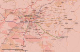


Abu al-Duhur Airbase
Hold cursor over location to display name; click to go to location row in the "table of cities and towns" (if available).
 Government-held ;
  Opposition-held (except ISIL) ;
  ISIL-held ;
  Kurd-held
Contested : Gov't-main rebels ;
  gov't-kurds ;
  gov't-ISIS ;
  main rebels-kurds ;
  main rebels-ISIS ;
  kurds-ISIS ;
  3-way ;
 Military base ;
  Airport/Air base (jet) ;
  Airport/Air base (helicopter)
  Major port or naval base;
  Border Post ;
  Dam ;
Dam ;  Industrial complex
2 nested circles: inner controls, outer sieges (or indicates strong enemy pressure) // 3 nested circles: mixed control with stable situation
Small icons within large circle: situation in individual neighbourhoods/districts
Contested :
2 nested circles: inner controls, outer sieges (or indicates strong enemy pressure) // 3 nested circles: mixed control with stable situation
Small icons within large circle: situation in individual neighbourhoods/districts
| This template may have no transclusions, because it is substituted by a tool or script, it is used as part of a short-term or less active Wikipedia process, or for some other reason. |
| This template uses Lua: |
Transclude this template by using {{Syrian Civil War detailed map}}. No parameters should be provided.
How war map template work with other parts of Wikipedia
