Enoch Cree Nation: Difference between revisions
Typo: "When Chef Lapotac died ..." -> "When Chief Lapotac died ..." |
|||
| Line 57: | Line 57: | ||
==History== |
==History== |
||
The Plains Cree people were [[hunter-gatherers]] roaming the [[Great Plains|Canadian plains]]. Once the [[Hudson's Bay Company]] created forts, the First Nations largely embraced the [[fur trade]]. [[Chief Lapotac]] was the earliest known leader of the Enoch Cree; he was probably descended from the Strongwood Cree, the original people of the Beaver River area east of [[Fort Edmonton]]. The Lapotac band was recognized by the Crown in 1842. When |
The Plains Cree people were [[hunter-gatherers]] roaming the [[Great Plains|Canadian plains]]. Once the [[Hudson's Bay Company]] created forts, the First Nations largely embraced the [[fur trade]]. [[Chief Lapotac]] was the earliest known leader of the Enoch Cree; he was probably descended from the Strongwood Cree, the original people of the Beaver River area east of [[Fort Edmonton]]. The Lapotac band was recognized by the Crown in 1842. When Chief Lapotac died in 1861, his son [[Thomas Lapotac]] became the Chief of the “Tommy’s Band”. In 1883 Chief Tommy Lapotac died and his brother [[Enoch Lapotac]] became chief. In 1884, Chief Enoch Lapotac joined other chiefs and signed Treaty 6. The result was the creation of "Tommy's Reserve".<ref name="History">{{cite web |title=Enoch Cree Nation History |url=http://www.enochecdev.ca/ecn-community-profile/ecn-history/ |publisher=River Cree Development Corporation |access-date=November 22, 2019}}</ref><ref>{{cite book|last1=Goyette|first1=Linda|last2=Roemmich|first2=Carolina Jakeway|title=Edmonton in Our Own Words|url=https://books.google.com/books?id=JRtWO4osCYYC&pg=PA417|date=April 2005|publisher=University of Alberta|isbn=978-0-88864-449-7|page=417}}</ref> Tommy's reserve, which became Indian Reserve No. 135, the Stony Plain Indian Reserve, and finally Enoch Cree Nation, was originally 44 sections of land ({{cvt|44|sqmi|disp=or}}) including access to the [[North Saskatchewan River]] on the southeast corner.<ref name="Houle">{{cite web |last1=Houle |first1=Rob |title=The Curious Case of the 1908 Enoch Surrender |website=Edmonton City as Museum Project |date=November 15, 2016|url=https://citymuseumedmonton.ca/2016/11/15/the-curious-case-of-the-1908-enoch-surrender/}}</ref><ref>{{cite web |title=Stony Plain. Treaty No. 6, N.W.T. Plan of Indian Reserve No. 135. Chief Tommy La Potac |url=http://www.lac-bac.gc.ca/databases/indian-reserves/001004-119.02-e.php?&isn_id_nbr=2807&interval=20&page_sequence_nbr=1&&PHPSESSID=3c5q689mm0ldirbqka8mme3r21 |website=Indian Reserves – Western Canada |publisher=[[Library and Archives Canada]] |date=January 17, 2007}}</ref> The band's land mass was reduced by forced surrender in 1902 and 1908 to nearly half of its original size.<ref name="History"/> On January 20, 1902, the northern 12 sections (out of the original 44) were surrendered and sold to private (non-First Nation) buyers.<ref name="Houle"/><ref>{{cite web |title=Treaty No. 6, North West Territories. Plan showing subdivision survey of the north part of the Stony Plain Indian Reserve No. 135, for which a surrender was taken from Chief Enoch's band on 20th January, 1902 |website=Indian Reserves – Western Canada |publisher=Library and Archives Canada |date=January 17, 2007 |url=http://www.lac-bac.gc.ca/databases/indian-reserves/001004-119.02-e.php?&isn_id_nbr=65&interval=50&page_sequence_nbr=1&&PHPSESSID=3c5q689mm0ldirbqka8mme3r21}}</ref> On May 13, 1908, 10 additional sections on the east side, including river access, were surrendered.<ref>{{cite web |title=Plan of Stony Plain Indian Reserve No. 135 in Township 52, R's. 25 and 26, W. of the 4th, showing surrendered portion |website=Indian Reserves – Western Canada |publisher=Library and Archives Canada |date=January 17, 2007 |url=http://www.lac-bac.gc.ca/databases/indian-reserves/001004-119.02-e.php?&isn_id_nbr=66&interval=50&page_sequence_nbr=1&&PHPSESSID=3c5q689mm0ldirbqka8mme3r21}}</ref> The legitimacy of the surrender was questioned and it took until July 29, 1908, for the government to officially accept it. It is disputed whether the band received fair market value for their surrendered land or were even compensated at all.<ref name="Houle"/> |
||
==Economy== |
==Economy== |
||
Revision as of 01:10, 13 May 2022
 | |
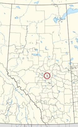
 Location in Alberta | |
| People | Cree |
|---|---|
| Treaty | Treaty 6 |
| Headquarters | Enoch |
| Province | Alberta |
| Land[1] | |
| Main reserve | Enoch Cree Nation 135 |
| Other reserve(s) | |
| Land area | 53.082 km2 |
| Population (October 2019)[1] | |
| On reserve | 1794 |
| On other land | 43 |
| Off reserve | 951 |
| Total population | 2788 |
| Government[1] | |
| Chief | William (Billy) Morin |
| Council |
|
| Website | |
| enochnation | |

The Enoch Cree Nation #440 (Template:Lang-cr, maskêkosihk) is a First Nations band government in Alberta, Canada. Members of the Nation are of Cree ancestry and speak the Plains Cree dialect of the Cree language group. The band is a signatory of Treaty 6 and is a member of the Confederacy of Treaty Six First Nations. The chief of the Enoch Cree Nation is William (Billy) Morin.[2]
Location
The Nation controls two reserves: the larger reserve, Enoch Cree Nation 135 is 20 square miles (52 km2) (20 sections) or officially 5,306.20 hectares (13,111.9 acres)[3] and west of, and adjacent to, the City of Edmonton and surrounded by Parkland County on the north, west, and south. Alberta Highway 60 cuts north–south through the center of the reserve. The smaller reserve, 135A is officially 2 hectares (4.9 acres) located 43 km (27 mi) south of the Town of Barrhead.[4]
Population
As of October 2019[update], approximately 1,800 band members live on the larger reserve, while others reside elsewhere within the Edmonton Metropolitan Region. The total registered population of the Nation was 2,789 in September 2019.[5]
Statistics Canada in the 2016 census refers to the reserve as "Stony Plain 135 Indian Reserve". At the time of the census, there were 1,690 residents on the reserve, up 71.2% from the 987 people found on the 2011 census.[6]
History
The Plains Cree people were hunter-gatherers roaming the Canadian plains. Once the Hudson's Bay Company created forts, the First Nations largely embraced the fur trade. Chief Lapotac was the earliest known leader of the Enoch Cree; he was probably descended from the Strongwood Cree, the original people of the Beaver River area east of Fort Edmonton. The Lapotac band was recognized by the Crown in 1842. When Chief Lapotac died in 1861, his son Thomas Lapotac became the Chief of the “Tommy’s Band”. In 1883 Chief Tommy Lapotac died and his brother Enoch Lapotac became chief. In 1884, Chief Enoch Lapotac joined other chiefs and signed Treaty 6. The result was the creation of "Tommy's Reserve".[7][8] Tommy's reserve, which became Indian Reserve No. 135, the Stony Plain Indian Reserve, and finally Enoch Cree Nation, was originally 44 sections of land (44 sq mi or 110 km2) including access to the North Saskatchewan River on the southeast corner.[9][10] The band's land mass was reduced by forced surrender in 1902 and 1908 to nearly half of its original size.[7] On January 20, 1902, the northern 12 sections (out of the original 44) were surrendered and sold to private (non-First Nation) buyers.[9][11] On May 13, 1908, 10 additional sections on the east side, including river access, were surrendered.[12] The legitimacy of the surrender was questioned and it took until July 29, 1908, for the government to officially accept it. It is disputed whether the band received fair market value for their surrendered land or were even compensated at all.[9]
Economy

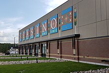
Once the band entered the reserve, their economy was largely based on agriculture. Oil was discovered on the reserve in 1947 and became a major source of band funding. The fall in oil prices oil 1986 lead the band to look for new revenue sources.[7] In October 2006 the Nation opened the River Cree Resort and Casino, a CA$180-million casino, hotel and sports complex located on the northeast corner of the larger reserve, adjacent to the City of Edmonton.[13]
Environment
As of 2014[update], the band is in negotiations with the Canadian Crown regarding land claim settlements over the use of reserve land by the Department of Defence as a bombing range during the Second World War.[14]
Notable people
- Ashley Callingbull-Burnham, actress[15]
- Bill LaForge, ice hockey coach[16][17]
- Crystle Lightning, musician
References
- ^ "First Nation Detail". Indigenous and Northern Affairs Canada. September 26, 2019.
- ^ pderas. "Office of the Chief - Departments and Programs". Enoch Cree Nation. Retrieved January 30, 2022.
- ^ pderas. "About Us". Enoch Cree Nation. Retrieved January 30, 2022.
- ^ "Reserves/Settlements/Villages". Indigenous and Northern Affairs Canada. September 26, 2019.
- ^ "Population Characteristics". Indigenous and Northern Affairs Canada. September 26, 2019.
- ^ "Enoch Cree Nation (Code 4811804) Census Profile". 2016 census. Government of Canada - Statistics Canada.
- ^ a b c "Enoch Cree Nation History". River Cree Development Corporation. Retrieved November 22, 2019.
- ^ Goyette, Linda; Roemmich, Carolina Jakeway (April 2005). Edmonton in Our Own Words. University of Alberta. p. 417. ISBN 978-0-88864-449-7.
- ^ a b c Houle, Rob (November 15, 2016). "The Curious Case of the 1908 Enoch Surrender". Edmonton City as Museum Project.
- ^ "Stony Plain. Treaty No. 6, N.W.T. Plan of Indian Reserve No. 135. Chief Tommy La Potac". Indian Reserves – Western Canada. Library and Archives Canada. January 17, 2007.
- ^ "Treaty No. 6, North West Territories. Plan showing subdivision survey of the north part of the Stony Plain Indian Reserve No. 135, for which a surrender was taken from Chief Enoch's band on 20th January, 1902". Indian Reserves – Western Canada. Library and Archives Canada. January 17, 2007.
- ^ "Plan of Stony Plain Indian Reserve No. 135 in Township 52, R's. 25 and 26, W. of the 4th, showing surrendered portion". Indian Reserves – Western Canada. Library and Archives Canada. January 17, 2007.
- ^ "River Cree Resort & Casino". Paragon Gaming. Retrieved November 22, 2019.
- ^ Gerson, Jen (May 2, 2014). "Bomb Hazard: An Alberta First Nation's land may be littered with unexploded WWII ordnance". National Post.
- ^ "Ashley Callingbull". Miss Universe Canada. Retrieved December 20, 2015.
- ^ Gallagher, Danny (June 25, 2005). "Bill LaForge, Hockey Coach". The Globe and Mail. Toronto. Canadian Press. pp. S9.
- ^ "LaForge Stresses Emotion". Nanaimo Daily News. Nanaimo, British Columbia: Publisher Extra Newspapers. Canadian Press. May 19, 1984. p. 11.
