Costislost: Difference between revisions
Appearance
Content deleted Content added
SimLibrarian (talk | contribs) mNo edit summary Tags: Mobile edit Mobile app edit iOS app edit |
Necrothesp (talk | contribs) infobox |
||
| Line 1: | Line 1: | ||
{{Short description|Grade II listed house in Cornwall, England}} |
{{Short description|Grade II listed house in Cornwall, England}} |
||
{{Use dmy dates|date=April 2022}} |
{{Use dmy dates|date=April 2022}} |
||
{{Infobox historic site |
|||
| ⚫ | |||
| name = Costislost |
|||
| native_name = |
|||
| native_language = |
|||
| ⚫ | |||
| caption = The entrance to Costislost |
|||
| type = |
|||
| locmapin = Cornwall |
|||
| coordinates = {{coord|50.4984|-4.7819}} |
|||
| location = [[Egloshayle]], [[Cornwall]], England |
|||
| area = |
|||
| built = |
|||
| architect = |
|||
| architecture = |
|||
| governing_body = |
|||
| owner = |
|||
| designation1 = Grade II |
|||
| designation1_offname = Costilost [sic] Farmhouse |
|||
| designation1_date = 4 November 1988 |
|||
| designation1_number = {{listed building England|1311181}} |
|||
}} |
|||
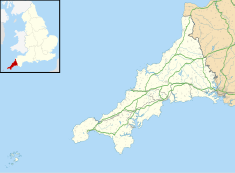
'''Costislost''' is a [[Listed building|Grade II listed house]] in the parish of [[Egloshayle]] in [[Cornwall]], England.<ref name=OS200>{{cite map|title=Ordnance Survey: Landranger map sheet 200 ''Newquay & Bodmin''|ISBN=978-0-319-22938-5|publisher=Ordnance Survey}}</ref> To the south are Costislost Plantations. |
'''Costislost''' is a [[Listed building|Grade II listed house]] in the parish of [[Egloshayle]] in [[Cornwall]], England.<ref name=OS200>{{cite map|title=Ordnance Survey: Landranger map sheet 200 ''Newquay & Bodmin''|ISBN=978-0-319-22938-5|publisher=Ordnance Survey}}</ref> To the south are Costislost Plantations. |
||
It dates to probably the 17th century, and underwent remodelling in the 18th and 19th centuries. The property was a farmhouse for centuries<ref>{{cite web|url=http://www.britishlistedbuildings.co.uk/en-67634-costilost-farmhouse-egloshayle-|title=Costislost Farmhouse|publisher=British Listed Buildings|accessdate=9 December 2015}}</ref> and belonged to the Lakeman family in the 19th century.<ref name="Maclean1871">{{cite book|last=Maclean|first=Sir John|title=Parochial and Family History of the Parish of Egloshayle in the County of Cornwall|url=https://books.google.com/books?id=8QEWAAAAYAAJ&pg=PA25|year=1871|publisher=Nichols & Sons|page=25}}</ref> |
It dates to probably the 17th century, and underwent remodelling in the 18th and 19th centuries. The property was a farmhouse for centuries<ref>{{cite web|url=http://www.britishlistedbuildings.co.uk/en-67634-costilost-farmhouse-egloshayle-|title=Costislost Farmhouse|publisher=British Listed Buildings|accessdate=9 December 2015}}</ref> and belonged to the Lakeman family in the 19th century.<ref name="Maclean1871">{{cite book|last=Maclean|first=Sir John|title=Parochial and Family History of the Parish of Egloshayle in the County of Cornwall|url=https://books.google.com/books?id=8QEWAAAAYAAJ&pg=PA25|year=1871|publisher=Nichols & Sons|page=25}}</ref> |
||
Revision as of 15:58, 11 July 2024
| Costislost | |
|---|---|
 The entrance to Costislost | |
| Location | Egloshayle, Cornwall, England |
| Coordinates | 50°29′54″N 4°46′55″W / 50.4984°N 4.7819°W |
Listed Building – Grade II | |
| Official name | Costilost [sic] Farmhouse |
| Designated | 4 November 1988 |
| Reference no. | 1311181 |
Costislost is a Grade II listed house in the parish of Egloshayle in Cornwall, England.[1] To the south are Costislost Plantations. It dates to probably the 17th century, and underwent remodelling in the 18th and 19th centuries. The property was a farmhouse for centuries[2] and belonged to the Lakeman family in the 19th century.[3]
Today it is run as an organic retreat and nutritional health centre.[4]
References
- ^ Ordnance Survey: Landranger map sheet 200 Newquay & Bodmin (Map). Ordnance Survey. ISBN 978-0-319-22938-5.
- ^ "Costislost Farmhouse". British Listed Buildings. Retrieved 9 December 2015.
- ^ Maclean, Sir John (1871). Parochial and Family History of the Parish of Egloshayle in the County of Cornwall. Nichols & Sons. p. 25.
- ^ "Costislost". Costislosthouse.co.uk. Retrieved 9 December 2015.
50°29′54″N 4°46′55″W / 50.4984°N 4.7819°W

