
Marion, Arkansas: Difference between revisions
→Geography: Updated Area of town with 2010 census data |
Updated statistical info with 2010 census data. |
||
| Line 20: | Line 20: | ||
|subdivision_name2 = [[Crittenden County, Arkansas|Crittenden]] |
|subdivision_name2 = [[Crittenden County, Arkansas|Crittenden]] |
||
|government_type = |
|government_type = |
||
|leader_title = |
|||
| |
|area_total_km2 = 52.89 |
||
| |
|area_total_sq_mi = 20.42 |
||
|area_magnitude = |
|||
|area_total_km2 = 34.8 |
|||
|area_total_sq_mi = 13.4 |
|||
|area_land_km2 = 34.8 |
|||
|area_land_sq_mi = 13.4 |
|||
|area_water_km2 = 0 |
|||
|area_water_sq_mi = 0 |
|||
|elevation_ft = 226 |
|elevation_ft = 226 |
||
|elevation_m = 69 |
|elevation_m = 69 |
||
|population_as_of = 2010 |
|population_as_of = 2010 |
||
|population_footnotes = |
|||
|population_total = 12345 |
|population_total = 12345 |
||
| |
|||
|population_metro = |
|||
|population_density_km2 = 255.8 |
|||
|population_density_sq_mi = 664.3 |
|||
|timezone = [[Central Time Zone (North America)|Central (CST)]] |
|timezone = [[Central Time Zone (North America)|Central (CST)]] |
||
|utc_offset = -6 |
|utc_offset = -6 |
||
| Line 56: | Line 46: | ||
|website = |
|website = |
||
}} |
}} |
||
Marion is a city |
Marion is a city and the county seat of [[Crittenden County, Arkansas|Crittenden County]], [[Arkansas]], [[United States]]. The population was 12,345 at the [[2010 United States Census|2010 census]], a 38.7% increase over the decade 2000-2010 <ref> http://quickfacts.census.gov/qfd/states/05/0544180.html </ref>. The city is part of the [[Memphis,Tennessee|Memphis]] metropolitan area. It is the second largest city in Crittenden County, behind [[West Memphis, Arkansas|West Memphis]]. |
||
==Geography== |
==Geography== |
||
Revision as of 20:43, 21 February 2012
Marion, Arkansas | |
|---|---|
 Welcome to Marion sign | |
 Location in Crittenden County and the state of Arkansas | |
| Country | United States |
| State | Arkansas |
| County | Crittenden |
| Area | |
| • Total | 20.42 sq mi (52.89 km2) |
| Elevation | 226 ft (69 m) |
| Population (2010) | |
| • Total | 12,345 |
| Time zone | UTC-6 (Central (CST)) |
| • Summer (DST) | UTC-5 (CDT) |
| ZIP code | 72364 |
| Area code | 870 |
| FIPS code | 05-44180 |
| GNIS feature ID | 0077597 |
Marion is a city and the county seat of Crittenden County, Arkansas, United States. The population was 12,345 at the 2010 census, a 38.7% increase over the decade 2000-2010 [1]. The city is part of the Memphis metropolitan area. It is the second largest city in Crittenden County, behind West Memphis.
Geography
Marion is located at 35°12′22″N 90°12′6″W / 35.20611°N 90.20167°W (35.206092, -90.201734).Template:GR
According to the United States Census Bureau, the city has a total area of 20.42 square miles (52.9 km2), all land. [2]
Transportation
Major Highways
Marion is bisected by ![]() Interstate 55 and is located just to the north of it's junction with Interstate 40 prior to it's crossing of the Mississippi River en route to Memphis. U.S. Highway 64 is the major East-West route through the town. Highway 77 is a major North-South arterial road east of Interstate 55 and Highway 118 is the major North-South arterial road west of Interstate 55.
Interstate 55 and is located just to the north of it's junction with Interstate 40 prior to it's crossing of the Mississippi River en route to Memphis. U.S. Highway 64 is the major East-West route through the town. Highway 77 is a major North-South arterial road east of Interstate 55 and Highway 118 is the major North-South arterial road west of Interstate 55.
Aviation
Marion is served for General Aviation by the West Memphis Municipal Airport (KAWM) [3]. General DeWitt Spain Airport is a civil aviation airport just north of downtown Memphis. The Memphis International Airport is nearby and provides commercial aviation through numerous carriers and is the international cargo hub for FedEx.
Rail
Union Pacific operates a 600 Acre intermodal facility west of Marion, Arkansas [4]. BNSF Railway also operates a intermodal yard in Marion.
Limited Passenger Rail is available on Amtrak at Memphis Central Station in nearby Memphis. The City of New Orleans runs twice daily on a North-South route from Chicago to New Orleans [5].
Water
Crittenden County and West Memphis jointly operate a port on the Mississippi River [6]. The International Port of Memphis lies just across the Mississippi River via ![]() Interstate 55. The International Port of Memphis is the 4th largest inland port in the United States [7].
Interstate 55. The International Port of Memphis is the 4th largest inland port in the United States [7].
Demographics
2010 Census [8]
As of the censusTemplate:GR of 2010, there were 12,345 people and 4,278 households in the city. The population density was 604.4 people per square mile (256.1/km²). The racial makeup of the city was 68.1% White, 28% Black or African American, 0.4% Native American, 1.5% Asian, 1.4% from two or more races. 2.0% of the population were Hispanic or Latino of any race.
88% of the population had a High School Diploma and 28% reported a Bachelor's Degree or higher. 2.5 of the population is foreign born and 4.4% report a language other than English being spoken at home. The home ownership rate was 71.3% at a median value of $142,200. The Median household income was $60,051. 7.3% of the population are below the poverty line.
Public schools
- Avondale Elementary School (grades pre-k through 1st grade
- Marion Elementary School (grades 2nd through 3rd)
- Marion Intermediate School (grades 4 through 5)
- Marion Middle School (grades 6 though 7)
- Marion Jr. High School (grades 8 through 9)
- Marion High School (grades 10-12)
References
- ^ http://quickfacts.census.gov/qfd/states/05/0544180.html
- ^ http://quickfacts.census.gov/qfd/states/05/0544180.html
- ^ http://www.ci.west-memphis.ar.us/airport.htm
- ^ http://www.uprr.com/aboutup/usguide/attachments/state_factsheets/ar.pdf
- ^ http://www.amtrak.com/servlet/ContentServer?c=AM_Route_C&pagename=am%2FLayout&cid=1241245653236
- ^ http://westmemphis.com/industrial-sites/better-access/river
- ^ http://www.portofmemphis.com/about.asp
- ^ http://quickfacts.census.gov/qfd/states/05/0544180.html
External links
Municipalities and communities of Crittenden County, Arkansas, United States | ||
|---|---|---|
| Cities | 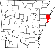 | |
| Towns | ||
| Unincorporated communities | ||


