Indiana County, Pennsylvania: Difference between revisions
No edit summary |
reinstated adj countries |
||
| Line 36: | Line 36: | ||
*[[Westmoreland County, Pennsylvania|Westmoreland County]] (south) |
*[[Westmoreland County, Pennsylvania|Westmoreland County]] (south) |
||
*[[Armstrong County, Pennsylvania|Armstrong County]] (north) |
*[[Armstrong County, Pennsylvania|Armstrong County]] (north) |
||
==Environment== |
|||
Indiana County includes the highly polluting [[Homer City Generating Station]] coal-burning power plant as well as the [[Keystone Power Plant]] which is the #4 [[mercury]] polluter in the USA. Both release large amounts of toxic mercury, ''far in excess of safe levels.'' (See here: [http://www.whitehouseforsale.org/documents/dirtiest_plants2.pdf Dirtiest Plants 2003]. Pennsylvania ranked the Homer City plant the #2 polluter in the state [http://www.pittsburghlive.com/x/pittsburghtrib/s_103122.html as reported here]. |
|||
Indiana County in 2003 was recommended for EPA non-compliance with smog levels ([http://www.transact.org/nrdc/ozoneappendix.htm info here]). |
|||
==Demographics== |
==Demographics== |
||
Revision as of 16:10, 18 May 2006
Indiana County | |
|---|---|
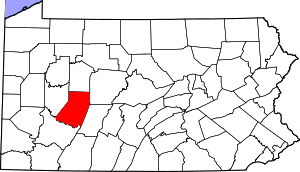
 Location within the U.S. state of Pennsylvania | |
 Pennsylvania's location within the U.S. | |
| Coordinates: 40°39′N 79°05′W / 40.65°N 79.09°W | |
| Country | |
| State | |
| Founded | March 30, 1803 |
| Seat | Indiana |
| Population (2000) | |
| • Total | 89,605 |
| Website | www |
Indiana County is a county located in the state of Pennsylvania. As of 2000, the population is 89,605. Indiana County was added to the Pittsburgh Metropolitan Statistical Area in 2003.
Indiana County was created on March 30, 1803 from parts of Westmoreland and Lycoming Counties.
Its county seat is Indiana6.
The county proclaims itself the "Christmas Tree Capital of the World", shipping over one million trees annually.
Indiana is the birthplace of actor Jimmy Stewart.
Geography
According to the U.S. Census Bureau, the county has a total area of 2,161 km² (834 mi²). 2,148 km² (829 mi²) of it is land and 13 km² (5 mi²) of it is water. The total area is 0.60% water.
Adjacent Counties
- Jefferson County (north)
- Clearfield County (east)
- Cambria County (southeast)
- Westmoreland County (south)
- Armstrong County (north)
Environment
Indiana County includes the highly polluting Homer City Generating Station coal-burning power plant as well as the Keystone Power Plant which is the #4 mercury polluter in the USA. Both release large amounts of toxic mercury, far in excess of safe levels. (See here: Dirtiest Plants 2003. Pennsylvania ranked the Homer City plant the #2 polluter in the state as reported here.
Indiana County in 2003 was recommended for EPA non-compliance with smog levels (info here).
Demographics
As of the census2 of 2000, there were 89,605 people, 34,123 households, and 22,521 families residing in the county. The population density was 42/km² (108/mi²). There were 37,250 housing units at an average density of 17/km² (45/mi²). The racial makeup of the county was 96.87% White, 1.57% Black or African American, 0.08% Native American, 0.74% Asian, 0.01% Pacific Islander, 0.16% from other races, and 0.58% from two or more races. 0.51% of the population were Hispanic or Latino of any race.
There were 34,123 households out of which 27.90% had children under the age of 18 living with them, 54.30% were married couples living together, 8.20% had a female householder with no husband present, and 34.00% were non-families. 26.50% of all households were made up of individuals and 11.80% had someone living alone who was 65 years of age or older. The average household size was 2.47 and the average family size was 2.99.
In the county, the population was spread out with 21.10% under the age of 18, 16.60% from 18 to 24, 24.80% from 25 to 44, 22.70% from 45 to 64, and 14.90% who were 65 years of age or older. The median age was 36 years. For every 100 females there were 94.00 males. For every 100 females age 18 and over, there were 90.60 males.
Municipalities

Boroughs
Townships
Education
Public School Districts
- Blairsville-Saltsburg School District
- Homer-Center School District
- Indiana Area School District
- Marion Center Area School District
- Penns Manor Area School District
- Purchase Line School District
- United School District

