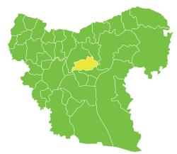
Al-Bab District: Difference between revisions
Appearance
Content deleted Content added
Rescuing 1 sources and tagging 0 as dead. #IABot (v1.4beta4) |
|||
| Line 12: | Line 12: | ||
| population_est = |
| population_est = |
||
| pop_est_date = |
| pop_est_date = |
||
| pop_ref = <ref name=census2004>{{cite web |
| pop_ref = <ref name=census2004>{{cite web|title=General Census of Population and Housing 2004 |url=http://www.cbssyr.sy/General%20census/census%202004/pop-man.pdf |publisher=Syrian [[Central Bureau of Statistics (Syria)|Central Bureau of Statistics]] |language=ar |accessdate=15 October 2015 |deadurl=yes |archiveurl=https://web.archive.org/web/20151208115353/http://www.cbssyr.sy/General%20census/census%202004/pop-man.pdf |archivedate=8 December 2015 }} Also available in English: {{cite web|title=2004 Census Data |url=https://data.humdata.org/dataset/syrian-arab-republic-other-0-0-0-0-0-0-0 |publisher=[[United Nations Office for the Coordination of Humanitarian Affairs|UN OCHA]] |accessdate=15 October 2015 }}</ref> |
||
| geocode = SY0202 |
| geocode = SY0202 |
||
| footnotes = |
| footnotes = |
||
Revision as of 06:14, 29 June 2017
Template:Infobox Syrian district
al-Bab District (Arabic: منطقة الباب, romanized: manṭiqat al-Bāb) is a district of Aleppo Governorate in northern Syria. Administrative centre is the city of al-Bab.
The administrative center of al-Rai Subdistrict shown above is the city of al-Rai.
The administrative center of al-Bab Subdistrict shown above is the city of al-Bab.
The administrative center of Arima Subdistrict shown above is the city of Arima.
The administrative center of Tadef Subdistrict shown above is the city of Tadef.
The district was split in 2009, when three southern subdistricts were separated to form the new Dayr Hafir District.[1] At the 2004 census, the remaining subdistricts had a total population of 201,589.[2]
Subdistricts
The district of al-Bab is divided into four subdistricts or nawāḥī (population as of 2004[2]):
| Code | Name | Area | Population | Seat |
|---|---|---|---|---|
| SY020200 | al-Bab Subdistrict | 489.28 km² | 112,219 | al-Bab |
| SY020201 | Tadef Subdistrict | 321.24 km² | 41,951 | Tadef |
| SY020202 | al-Rai Subdistrict | 352.30 km² | 15,378 | al-Rai |
| SY020203 | Arima Subdistrict | 317.38 km² | 32,041 | Arima |
References
- ^ "إحداث منطقتي دير حافر والأتارب سيساهم في النهضة التنموية بالمحافظة". Al-Jamahir (in Arabic). Aleppo. 25 February 2009. Retrieved 24 January 2016.
- ^ a b Cite error: The named reference
census2004was invoked but never defined (see the help page).


