Elk Mountain (Carbon County, Wyoming)
Appearance
| Elk Mountain | |
|---|---|
 Elk Mountain, as seen from Rawlins. | |
| Highest point | |
| Elevation | 11,162 ft (3,402 m) NAVD 88[1] |
| Prominence | 3,296 ft (1,005 m)[2] |
| Coordinates | 41°38′00″N 106°31′34″W / 41.633243369°N 106.526158175°W[1] |
| Geography | |
| Parent range | Medicine Bow Mountains |
| Climbing | |
| Easiest route | Private road, hike. |

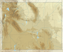
Elk Mountain is a peak at the northern end of the Medicine Bow Mountains. It is 7 miles (11 km) southwest of the town of Elk Mountain, Wyoming and roughly 38 miles (61 km) from Rawlins, Wyoming. The mountain is the area's most visible feature. It is located south of Interstate 80 in Carbon County. Elk Mountain is the 8th most prominent summit in the state of Wyoming.[3]
Radio station KBDY broadcasts from a tower on the summit. This allows the station to be received over a significant area with only 630 watts of effective radiated power.[4]
References
- ^ a b "Elk Mtn". NGS Data Sheet. National Geodetic Survey, National Oceanic and Atmospheric Administration, United States Department of Commerce. Retrieved 2011-05-15.
- ^ "Elk Mountain, Wyoming". Peakbagger.com. Retrieved 2011-05-15.
- ^ "Wyoming Peaks with 2000 feet of Prominence". Peakbagger.com. Retrieved 2011-05-15.
- ^ "KBDY-FM Radio Station Information". Radio-Locator. Retrieved 2011-05-15.

