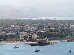
Tarrafal, Cape Verde
Tarrafal | |
|---|---|
Settlement | |
 View of the town of Tarrafal | |
| Coordinates: 15°16′41″N 23°45′07″W / 15.278°N 23.752°W | |
| Country | Cape Verde |
| Island | Santiago |
| Municipality | Tarrafal |
| Civil parish | Santo Amaro Abade |
| Population (2010)[1] | |
• Total | 6,656 |
| ID | 71120 |
Tarrafal (also: Mangui or Mangue) is a city[2] in the northern part of the island of Santiago, Cape Verde. In 2010 its population was 6,656. It is a fishing port situated on the northwestern coast. It constitutes the seat of the Tarrafal Municipality.
Geography


The city is situated by the Baía de Tarrafal, at the foot of 643 m high Monte Graciosa.[3] Tarrafal is at the northern end of two main roads to Praia in the south, one leading through Assomada and São Domingos (EN1-ST01), the other along the east coast through Calheta de São Miguel and Pedra Badejo (EN1-ST02).
History
The origin of the name Tarrafal is the indigenous plant tarrafe,[3] Tamarix senegalensis.[4] The settlement was mentioned in the 1747 map by Jacques-Nicolas Bellin as "Terrafal".[5] Tarrafal was the seat of the municipality of Santa Catarina from 1869 until 1912, when the seat was moved to Assomada.[6] In 1917, the municipality of Tarrafal was separated from Santa Catarina, and the town Tarrafal became its seat.[7] Between 1936 and 1974, political prisoners were held at the Tarrafal camp, south of the city. At least 32 prisoners died in the camp, which now houses a museum.[3]

Demographics
| Year | Population |
|---|---|
| 23 June 1990, census | 3,626 |
| 16 June 2000, census | 5,785 |
| 1 January 2005, estimate | 6,463 |
| 2010, census | 6,656 |

See also
References
- ^ "2010 Census results". Instituto Nacional de Estatística Cabo Verde (in Portuguese). 24 November 2016.
- ^ Cabo Verde, Statistical Yearbook 2015, Instituto Nacional de Estatística, p. 32-33
- ^ a b c Tarrafal guia turístico, Câmara municipal do Tarrafal
- ^ Tamarix senegalensis, Instituto de Investigação Científica Tropical
- ^ Jacques-Nicolas Bellin (1747). "Carte des Isles du Cap Verd = Kaart van de Eilanden van Kabo Verde" (in French).
- ^ Evolução histórica do Concelho de Santa Catarina (1834 – 1912), Ana Zenaida Gomes, 2005, p. 42
- ^ História Câmara municipal, Câmara municipal do Tarrafal

