Sang Run State Park
Appearance
| Sang Run State Park | |
|---|---|
 View along Ginseng Run in the park. | |
| Location | Sang Run, Maryland, United States |
| Nearest city | Frostburg, Maryland |
| Coordinates | 39°34′02″N 79°25′26″W / 39.5673097°N 79.4239307°W[1] |
| Area | 81 acres (33 ha)[2] |
| Elevation | 2,005 ft (611 m)[1] |
| Designation | Maryland state park |
| Established | 2017[3] |
| Administrator | Maryland Department of Natural Resources |
| Website | Sang Run State Park |
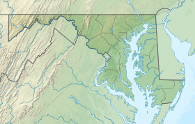
Sang Run State Park is a public recreation area covering 81 acres (33 ha) in Sang Run, Garrett County, Maryland.[3] Focal points of the state park are a homestead, Friends Delight, that dates from the early 1800s, and the historic Friends Store, which as a center of Sang Run's community life sold various staples and served as post office until the 1970s.[4] The park offers picnicking, hiking trail, and put-in for Class V whitewater rafting on the Youghiogheny River.[5]
References
- ^ a b "Sang Run Post Office". Geographic Names Information System. United States Geological Survey, United States Department of the Interior.
- ^ "DNR Lands Acreage" (PDF). Maryland Department of Natural Resources. p. 9. Retrieved January 10, 2020.
- ^ a b "Sang Run State Park". Maryland Department of Natural Resources. Retrieved January 10, 2020.
- ^ "Historic Friends Store". Maryland Department of Natural Resources. Retrieved January 10, 2020.
- ^ "Whitewater Put-in on the Youghiogheny River". Maryland Department of Natural Resources. Retrieved January 10, 2020.
External links
- Sang Run State Park Maryland Department of Natural Resources

