Dawadmi
Dawadmi
الدوادمي | |
|---|---|
| Al Dawadmi | |
 | |
| Coordinates: 24°39.7′N 44°23′E / 24.6617°N 44.383°E | |
| Country | |
| Province | Riyadh Province |
| Population (2004) | |
• Total | 300,001 |
| Time zone | UTC+3 (AST) |
| • Summer (DST) | UTC+3 (AST) |
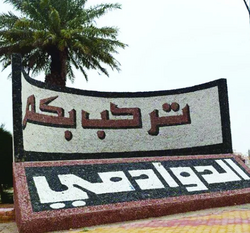
Dawadmi or Ad Dawadimi (Template:Lang-ar) is a town in Riyadh Province, Saudi Arabia. Google Maps spells the name as Al Duwadimi. As of the 2004 census it had a population of 53,071 people.[1] The town is mostly inhabited by the tribe of Banu 'Utaybah.
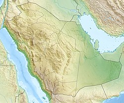
It is located on top of Najd hill, the central area of Saudi Arabia. [citation needed] It is about 200 kilometres (120 mi) west of Riyadh.[2] By road, is located 320 kilometres (200 mi) by road west of Riyadh.
In April 2003, the new airport in the city was inaugurated by the Crown Prince of Saudi Arabia. King Abdulaziz palace is a landmark of the city and there is an ongoing rehabilitation project to protect it.
Climate
| Climate data for Dawadmi, Saudi Arabia (2005-2015) | |||||||||||||
|---|---|---|---|---|---|---|---|---|---|---|---|---|---|
| Month | Jan | Feb | Mar | Apr | May | Jun | Jul | Aug | Sep | Oct | Nov | Dec | Year |
| Mean daily maximum °C (°F) | 21 (70) |
25 (77) |
28 (82) |
32 (90) |
38 (100) |
40 (104) |
41 (106) |
42 (108) |
39 (102) |
34 (93) |
26 (79) |
22 (72) |
32 (90) |
| Daily mean °C (°F) | 15 (59) |
18 (64) |
21 (70) |
25 (77) |
31 (88) |
34 (93) |
34 (93) |
35 (95) |
33 (91) |
27 (81) |
20 (68) |
15 (59) |
26 (78) |
| Mean daily minimum °C (°F) | 8 (46) |
11 (52) |
14 (57) |
19 (66) |
24 (75) |
27 (81) |
28 (82) |
28 (82) |
26 (79) |
20 (68) |
14 (57) |
9 (48) |
19 (66) |
| Average precipitation mm (inches) | 2.2 (0.09) |
2.4 (0.09) |
8.0 (0.31) |
16.4 (0.65) |
1.9 (0.07) |
0.1 (0.00) |
0.9 (0.04) |
1.9 (0.07) |
1.3 (0.05) |
0.4 (0.02) |
18.2 (0.72) |
5.0 (0.20) |
58.7 (2.31) |
| Average relative humidity (%) (daily average) | 32 | 24 | 21 | 20 | 13 | 8 | 8 | 8 | 10 | 16 | 33 | 35 | 19 |
| Average dew point °C (°F) | 0 (32) |
−1 (30) |
0 (32) |
2 (36) |
1 (34) |
−2 (28) |
−2 (28) |
−1 (30) |
0 (32) |
1 (34) |
4 (39) |
2 (36) |
0 (33) |
| Source: Time and Date[3] | |||||||||||||
History
Dawadmi town holds historical significance as one of the ancient human settlements located in the heart of the Arabian Peninsula. The mountains and valleys of the region are adorned with traces of human presence, including inscriptions, graffiti, and depictions of both humans and animals. Notably, faded images of large lions can be found, surrounded by remnants of mining operations and scattered stone rubble. These archaeological remnants provide evidence of the rich history and early human activity in the area.
Civilizations


The governorates of the Riyadh region are distinguished by a diverse cultural heritage, formed by the successive civilizations that this region experienced that left behind various archaeological monuments. The drawings, writings and rock engravings represent one of the most prominent archaeological monuments in the Riyadh region, which occupies a strategic location in the heart of the Arabian Peninsula.
Survey studies conducted by the Heritage Authority of the Ministry of Culture revealed the presence of more than 35 important archaeological sites in the Dawadmi Governorate, some of which contain animal inscriptions, drawings and historical writings dating back to the Paleolithic, Middle and Modern Stone Ages, the most important of which are two historical inscriptions written in the Sabaean script in “Masil al-Jamh Mountains.” The first inscription dates back to King “Abu Karib As’ad,” one of the most famous kings of Himyar, in the first third of the fifth century AD, and the second inscription dates back to the year 516 AD to King Ma’ad Yakrib al-Himyari. Both inscriptions indicate the presence of military campaigns launched against Some tribes of central Arabia.

Aside from these two inscriptions, there are inscriptions and drawings on large rocks of ibex and ostriches on the facades of the mountains in Dawadmi, in addition to inscriptions, rock drawings, and Islamic writings in the sites of “Qubi’a” and “Safqa,” and rock drawings of human and animal forms on the “Thalan Mountains” series, the most notable of which is the site. “Matiwi Dalaa” on the southwestern side.
At the “Halit” site, a group of Islamic inscriptions and writings were documented, which give a new dimension to the region’s history and civilization during the early Islamic period, and at the “Dhalayat Bin Nasser” site, rock drawings and Islamic inscriptions dating back to the early Islamic era were revealed.
Among the sites of ancient rock inscriptions in Dawadmi Governorate is the “Gharib” site, in which human inscriptions and drawings dating back to before Christ were found, in addition to inscriptions from various Islamic eras, in addition to the “Al-Daeina” site, in which Thamudic inscriptions appear on a sand mountain, rock drawings, and areas “Al-Nasifah” and “Hasat Faghran”, and in the “Miniya Plateau” in the northwest of the governorate, there are the ruins of “Miniya”, which the pre-Islamic poet Labid bin Rabi’ah Al-Amiri mentioned in his commentary. Its ruins are represented by rock facades bearing a group of faded drawings of animals, the most important of which are lions.
From an archaeological standpoint, Dawadmi is considered one of the most important sites that attracted the attention of researchers and those interested, as survey operations began there in 1979 AD, which contributed to the discovery of many archaeological sites and the finding of rare artifacts.
Al Dawadmi borders
Al-Dawadmi Governorate is a Saudi governorate located in the northwest of the Riyadh Region. It is affiliated with the Emirate of Riyadh Region. The governorate shares borders with Shaqra and Murat Governorates to the east, Afif Governorate to the west, and Al-Rass Governorate (administratively affiliated with Al-Qassim Region) to the north. To the south, it is bordered by Unaizah Governorate, Al-Mithnab Governorate, and Al-Bukayriyah Governorate, all of which are administratively part of the Qassim region. These governorates are adjacent to the northern part of the administrative scope of the city of Buraidah, which serves as the seat of the emirate of the Qassim region.
Covering an area of approximately 28,000 square kilometers, Al-Dawadmi governorate ranks fifth among the governorates in the region in terms of area. It is primarily located within the Arab Shield region, and its average width is 215 km. The governorate is notable for having a regional airport, distinguishing it from other governorates in the Riyadh region.
Name origin

The name "Al-Dawadmi" is believed to be derived from the abundance of a particular type of tree called Al-Dawadim. This tree is known for its use in tanning processes. The name may have originated from the region's notable presence of samar and acacia trees, which produce a reddish substance reminiscent of blood. These trees are plentiful in the area, giving rise to the name associated with their abundance and the significance of their products.
Mounments
- King Abdul Aziz Palace, situated to the west of Dawadmi, holds historical significance. It was commissioned by King Abdul Aziz on Safar 7, 1349 AH(approximately 1930 CE). The construction of the palace was entrusted to Abdul Rahman Abu Bakr, a respected figure from Dawadmi.
- Bassam Palace, also known as the Old Quarter, was the site of a significant battle between the forces of the first Saudi state and the Ottoman Turks.
See also
References
- ^ "Saudi Arabia: largest cities and towns and statistics of their population". World Gazetteer. Retrieved 27 August 2012.[dead link]
- ^ "Outrage over beheading of Sri Lankan woman by Saudi Arabia. " CNN. January 10, 2013. Retrieved on January 10, 2013.
- ^ "Climate & Weather Averages in Ad Dawadmi, Saudi Arabia". Time and Date. Retrieved 11 January 2022.


