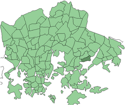
Marjaniemi
Appearance
Marjaniemi
Marudd | |
|---|---|
 Position of Marjaniemi within Helsinki | |
| Country | |
| Region | Uusimaa |
| Sub-region | Greater Helsinki |
| Municipality | Helsinki |
| District | Eastern |
| Subdivision regions | none |
| Area | 1.02 km2 (0.39 sq mi) |
| Population (2005) | 1,964 |
| Postal codes | 00930, 00931 |
| Subdivision number | 455 |
| Neighbouring subdivisions | Roihuvuori, Itäkeskus, Puotila, Meri-Rastila |
Marjaniemi (Swedish: Marudd) is a seaside residential area in eastern Helsinki, Finland, with a population of approximately 2,000. Administratively it forms a quarter in the neighbourhood of Vartiokylä.
Marjaniemi is a sought-after neighborhood, and the real estate prices rank among the highest in the city.[citation needed]
Politics
Results of the 2011 Finnish parliamentary election in Marjaniemi:
- National Coalition Party 41.7%
- Social Democratic Party 18.0%
- True Finns 12.2%
- Green League 9.5%
- Left Alliance 6.6%
- Swedish People's Party 4.6%
- Centre Party 3.7%
- Christian Democrats 1.9%
External links
 Media related to Marjaniemi at Wikimedia Commons


60°12′15″N 025°05′15″E / 60.20417°N 25.08750°E

