Hart-Miller Island State Park
| Hart-Miller Island State Park | |
|---|---|
 | |
| Location | Baltimore County, Maryland, United States |
| Nearest city | Baltimore, Maryland |
| Coordinates | 39°15′04″N 76°22′37″W / 39.25111°N 76.37694°W[2] |
| Area | 244 acres (99 ha)[3] |
| Elevation | 3 ft (0.91 m)[2] |
| Designation | Maryland state park |
| Established | 1977-78[4] |
| Administrator | Maryland Department of Natural Resources |
| Website | Hart-Miller Island State Park |
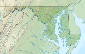
Hart-Miller Island State Park is a state-owned, public recreation area located on Hart-Miller Island, a man-made landfill linking three natural Chesapeake Bay islands—Hart, Miller, and Pleasure—near the mouth of Middle River in Maryland. The state park is accessible only by boat.[5]
History
Pleasure Island hosted the New Bay Shore amusement park from the late 1940s until it was shut down following excessive storm damage in the mid-1960s. The area comprising Hart, Miller, and Pleasure islands—with a total land surface of 250 acres (100 ha)—was acquired by the state in the late 1970s. A dike was built joining Hart and Miller islands into Hart Miller Island in 1983, and the subsequent containment area was filled with dredge material from Baltimore harbor and the Patapsco River over the next 20 years.[4][6]
Activities and amenities
The park features a 3,000-foot (910 m) sandy beach, hiking trails, an observation platform, picnicking facilities, and sites for overnight camping. The north cell of the island's 1,100-acre surface area is closed; the south cell officially opened for public access in May 2016.[5]
References
- ^ "Hart, Miller and Pleasure Islands State Park". Protected Planet. IUCN. Retrieved 1 May 2018.
- ^ a b "Hart-Miller Island State Park". Geographic Names Information System. United States Geological Survey, United States Department of the Interior.
- ^ "DNR Lands Acreage" (PDF). Maryland Department of Natural Resources. Retrieved December 9, 2019.
- ^ a b Arnold "Butch" Norden. "Hart-Miller Island State Park: Creating a Unique Resource Out of Dredged Material". Maryland Department of Natural Resources. Archived from the original on March 23, 2008. Retrieved January 1, 2014.
- ^ a b "Hart-Miller Island State Park". Maryland Department of Natural Resources. Retrieved November 20, 2013.
- ^ "Hart-Miller Island: The Final Frontier" (PDF). Gunpowder Currents. Maryland Park Service. Fall–Winter 2016. pp. 3–5. Retrieved November 3, 2017.
{{cite web}}: CS1 maint: date format (link)
External links
- Hart-Miller Island State Park Maryland Department of Natural Resources

