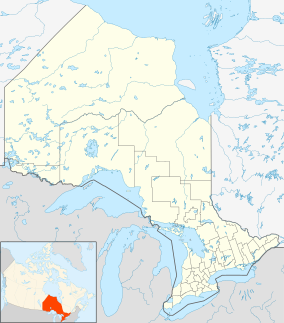
La Verendrye Provincial Park
| La Verendrye Provincial Park | |
|---|---|
| Location | Thunder Bay District, Ontario, Canada |
| Nearest city | Thunder Bay |
| Coordinates | 48°06′15″N 90°22′02″W / 48.10417°N 90.36722°W |
| Area | 182.80 km2 (70.58 sq mi) |
| Governing body | Ontario Parks |
La Verendrye Provincial Park is a waterway provincial park located in Ontario, Canada, on the border of Minnesota, United States. The park stretches from Quetico Provincial Park through Saganaga Lake, up the Pine River, across the Height of Land Portage, then down the Pigeon River to Pigeon River Provincial Park on Lake Superior. The park is named after Pierre Gaultier de Varennes, sieur de La Vérendrye an early explorer of Canada.
The park is a "non-operating" park, meaning no fees are charged and no staff is present with only few services offered. As part of the international boundary, the portages, lakes, and waterways along the border are open to the citizens of both nations.
La Verendrye Provincial Park is part of the historic voyageur fur trade route from Lake Superior to Winnipeg, and features several scenic diabase-capped mesas, as well as several types of rare and unusual plants.
See also
External links


