Campo Cuatro Milpas Airport
Appearance
Campo Cuatro Milpas National Airport Aeropuerto Nacional Campo Cuatro Milpas | |||||||||||
|---|---|---|---|---|---|---|---|---|---|---|---|
| Summary | |||||||||||
| Airport type | Public | ||||||||||
| Operator | Government | ||||||||||
| Serves | Guasave, Sinaloa, Mexico | ||||||||||
| Elevation AMSL | 92 ft / 28 m | ||||||||||
| Coordinates | 25°39′08″N 108°32′17″W / 25.65222°N 108.53806°W | ||||||||||
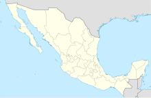
| Map | |||||||||||
| Runways | |||||||||||
| |||||||||||
| Statistics (2019) | |||||||||||
| |||||||||||
Source: Agencia Federal de Aviación Civil[1] | |||||||||||
Campo Cuatro Milpas National Airport (Spanish: Aeropuerto Nacional Campo Cuatro Milpas), also known as Guasave National Airport (Aeropuerto Nacional de Guasave), is an airport located at Guasave, a city located in the northwestern part of the state of Sinaloa in Mexico.[1]
Facilities
The airport resides at an elevation of 92 feet (28 m) above mean sea level. It has one runway designated 09/27 with an asphalt surface measuring 1,969 by 24 metres (6,460 ft × 79 ft).[1]
Airlines and destinations
| Airlines | Destinations |
|---|---|
| Aéreo Calafia | Cabo San Lucas |
References
- ^ a b c Airport information for Campo Cuatro Milpas from DAFIF (effective October 2006)
External links
- Aerial image of Campo Cuatro Milpas at OurAirports.com


